
Ficheiro:1630 19th Street, NW.JPG
Dimensões desta antevisão: 750 × 600 píxeis. Outras resoluções: 300 × 240 píxeis | 600 × 480 píxeis | 961 × 768 píxeis | 1 280 × 1 023 píxeis | 2 560 × 2 047 píxeis | 2 769 × 2 214 píxeis.
Imagem numa resolução maior (2 769 × 2 214 píxeis, tamanho: 1,54 MB, tipo MIME: image/jpeg)
|
|
Esta imagem provém do Wikimedia Commons, um acervo de conteúdo livre da Wikimedia Foundation que pode ser utilizado por outros projetos.
|
| Descrição |
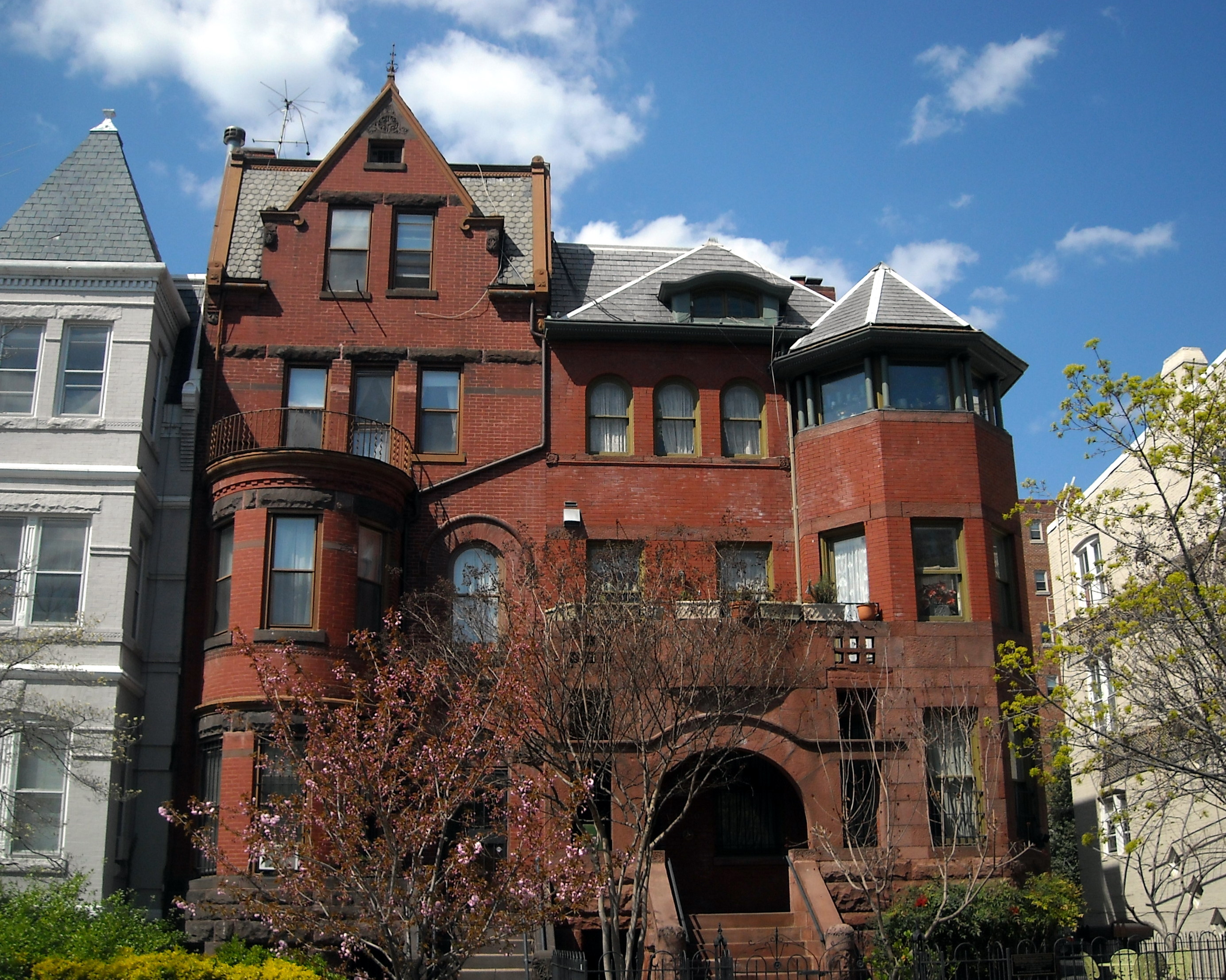
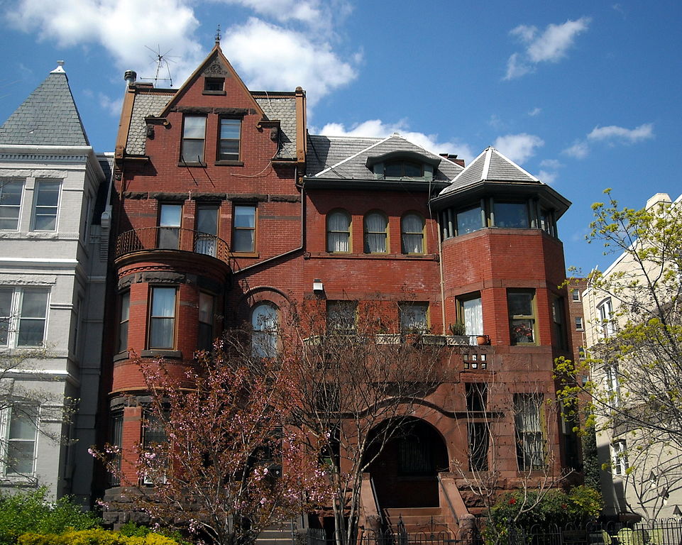
English: Homes located at 1628 (left) and 1630 (right) 19th Street NW in the Dupont Circle neighborhood of Washington, D.C. The buildings are contributing properties to the Dupont Circle Historic District, listed on the National Register of Historic Places in 1978. Previous occupants of 1628 19th Street NW, built in 1891 and designed by architect George S. Cooper, include Medical Director of the Navy Dr. Frank Anderson, Attorney General of Alabama William C. Fitts, attorney and Reporter of Decisions of the Supreme Court Charles Henry Butler, Solicitor of the Treasury Felix A. Reeve, Medal of Honor recipient Admiral William A. Moffett, Fannie L. Ricketts (widow of General James B. Ricketts), and Brigadier General Nelson B. Sweitzer. Previous occupants of 1630 19th Street NW, built around 1892 and designed by architect Clarence L. Harding, include Oklahoma Representative Alice Mary Robertson, treasurer of Southern Railway Harrie C. Ansley, and Adolph C. Miller's private secretary D.C. Elliott. |
| Data | |
| Origem | Obra do próprio |
| Autor | AgnosticPreachersKid |
| Permissão (Reutilizar este ficheiro) |
Eu, titular dos direitos de autor desta obra, publico-a com a seguinte licença: A utilização deste ficheiro é regulada nos termos da licença Creative Commons Atribuição-CompartilhaIgual 4.0 Internacional.
|
| Localização da câmara | | Esta e outras imagens nas suas localizações em: OpenStreetMap |
|---|
Histórico do ficheiro
Clique uma data e hora para ver o ficheiro tal como ele se encontrava nessa altura.
| Data e hora | Miniatura | Dimensões | Utilizador | Comentário | |
|---|---|---|---|---|---|
| atual | 12h01min de 2 de setembro de 2009 | | 2 769 × 2 214 (1,54 MB) | APK | {{Information |Description={{en|1=The Romanesque Revival building located at 1630 19th Street, NW in the Dupont Circle neighborhood of [[:e |
Utilização local do ficheiro
A seguinte página usa este ficheiro:
Utilização global do ficheiro
As seguintes wikis usam este ficheiro:
- en.wikipedia.org
- fr.wikipedia.org
- no.wikipedia.org
- uk.wikipedia.org