
Ficheiro:Maglic.jpg

Dimensões desta antevisão: 800 × 600 píxeis. Outras resoluções: 320 × 240 píxeis | 640 × 480 píxeis | 1 024 × 768 píxeis.
Imagem numa resolução maior (1 024 × 768 píxeis, tamanho: 212 kB, tipo MIME: image/jpeg)
|
|
Esta imagem provém do Wikimedia Commons, um acervo de conteúdo livre da Wikimedia Foundation que pode ser utilizado por outros projetos.
|
| Localização da câmara | | Esta e outras imagens nas suas localizações em: OpenStreetMap |
|---|
| Descrição |
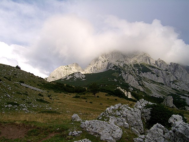
English: Maglić - the highest peak of Bosnia&Herzegovina Polski: Maglić - najwyższy szczyt Bośni i Hercegowiny Bosanski: Maglić - najviši planinski vrh Bosne i Hercegovine Українська: Гора Маґлич, Боснія та Герцеговина |
| Data | |
| Origem | Obra do próprio |
| Autor | Radosław Botev |
| Permissão (Reutilizar este ficheiro) |
This image is copyrighted by Radosław Botev. Permission is granted to use this picture freely for any purpose - whether commercial or not - and to make derivative works provided that the copyright holder's full name is quoted. You are also hereby permitted to redistribute this file and its derivations to a third party under any license of your choice as long as that license requires attribution to the copyright holder of this work and does not allow to ever revoke that requirement (possible examples are Creative Commons Attribution or GFDL). This shall by no means limit the right of the redistributor of this work or the right of the derivative works' creators to impose other restrictions on the use or further redistribution of this work or its derivations. English français polski +/- |
Eu, titular dos direitos de autor desta obra, publico-a com a seguinte licença:

|
O titular dos direitos de autor deste ficheiro autoriza o seu uso por qualquer pessoa para qualquer finalidade, com a condição de que a sua autoria seja devidamente atribuída. A redistribuição, obras derivadas, uso comercial e todos os demais usos são permitidos. |
|
|
English: This file was originally published under one of the following licenses: Creative Commons Attribution ShareAlike 2.5 Poland or Creative Commons Attribution 2.5 Poland and was later relicensed by its creator Radosław Botev. The current license is less restrictive and still permits the use of this image under the original license. Polski: Ten plik był pierwotnie opublikowany na jednej z następujących licencji: Creative Commons Uznanie Autorstwa - Na tych samych warunkach 2.5 Polska lub Creative Commons Uznanie Autorstwa 2.5 Polska. Twórca tej pracy Radosław Botev zmienił później licencję. Obecna licencja jest mniej restrykcyjna i wciąż zezwala na wykorzystanie tej grafiki na zasadach przewidzianych w pierwotnej licencji.
|
Histórico do ficheiro
Clique uma data e hora para ver o ficheiro tal como ele se encontrava nessa altura.
| Data e hora | Miniatura | Dimensões | Utilizador | Comentário | |
|---|---|---|---|---|---|
| atual | 09h50min de 13 de setembro de 2006 | | 1 024 × 768 (212 kB) | Botev | {{Information |Description=Sutjeska National Park |Source= |Date=September, 2006 |Author=Botev |Permission=own work |other_versions= }} |
Utilização local do ficheiro
As seguintes 2 páginas usam este ficheiro:
Utilização global do ficheiro
As seguintes wikis usam este ficheiro:
- ar.wikipedia.org
- azb.wikipedia.org
- be.wikipedia.org
- bg.wikipedia.org
- bs.wikipedia.org
- cs.wikipedia.org
- de.wikipedia.org
- eo.wikipedia.org
- es.wikipedia.org
- fa.wikipedia.org
- fr.wikipedia.org
- gl.wikipedia.org
- hr.wikipedia.org
- id.wikipedia.org
- it.wikipedia.org
- lmo.wikipedia.org
- lt.wikipedia.org
- mk.wikipedia.org
- mt.wikipedia.org
- nl.wikipedia.org
- no.wikipedia.org
- pl.wikipedia.org
- roa-rup.wikipedia.org
- ro.wikipedia.org
- ru.wikipedia.org
- sh.wikipedia.org
- sq.wikipedia.org
- sq.wikibooks.org
- sr.wikipedia.org
- uk.wikipedia.org
- vi.wikipedia.org
- www.wikidata.org