
Ficheiro:Mer de Glace sketchmap by John Tyndall, 1857, from 1896 edition.png
Imagem numa resolução maior (1 544 × 938 píxeis, tamanho: 448 kB, tipo MIME: image/png)
|
|
Esta imagem provém do Wikimedia Commons, um acervo de conteúdo livre da Wikimedia Foundation que pode ser utilizado por outros projetos.
|
| Descrição |
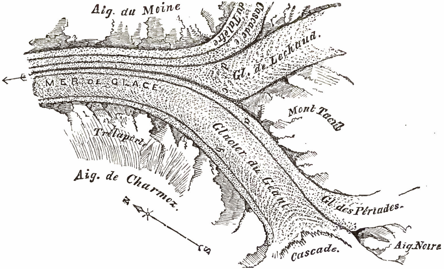
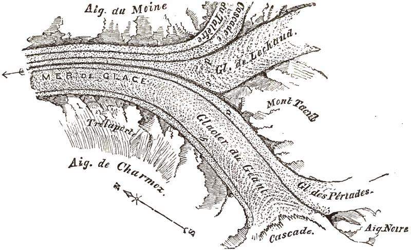
Mer de Glace sketchmap by John Tyndall, 1857 Fig. 7[1] shows Aiguille Noire to the south (bottom-right) dividing the Cascade at the west (bottom) from Glacier des Périades (right) which flows north to join Glacier du Géant flowing south to north (14 degrees clockwise) between Mont Tacul on the east (centre right) and Aiguilles de Charmoz to the west (bottom alongside morraine 'b'). This forms the medial morraine 'a'. Some 3 kilometres downstream, Glacier de Lechaud joins du Géant, forming medial morraine 'c'. Just prior to this confluence, Cascade du Talèfre, with its own medial morraine 'e', joins Lechaud forming morraine 'd'. Here the glacier is known as the Mer De Glace and flows north-north-west (leftwards) between Aiguille du Moine on the east and Trélaporte on the west. Notes
References
|
||||
| Data | |||||
| Origem | PDF from https://archive.org/details/glaciersalpsbeing00tyndrich or alternative: https://books.google.it/books?id=8_cN1DQ3mZ4C&printsec=frontcover&hl=en#PPA53,M1 | ||||
| Autor | John Tyndall (1820-1893) | ||||
| Permissão (Reutilizar este ficheiro) |
|
||||
Histórico do ficheiro
Clique uma data e hora para ver o ficheiro tal como ele se encontrava nessa altura.
| Data e hora | Miniatura | Dimensões | Utilizador | Comentário | |
|---|---|---|---|---|---|
| atual | 20h13min de 24 de setembro de 2016 | | 1 544 × 938 (448 kB) | Cmdrjameson | Compressed with pngout. Reduced by 275kB (38% decrease). |
| 18h36min de 29 de fevereiro de 2008 |  | 1 544 × 938 (724 kB) | Wikibob~commonswiki | {{Information |Description=Mer de Glace sketchmap by John Tyndall, 1857 Fig. 7<ref>Tyndall page 53 "Fig 7."</ref> shows Aiguille Noire to the south (bottom-right) dividing the Cascade at the west (bottom) from Glacier des Périades (right) which flows no |
Utilização local do ficheiro
A seguinte página usa este ficheiro:
Utilização global do ficheiro
As seguintes wikis usam este ficheiro:
- en.wikipedia.org
- es.wikipedia.org
- fr.wikipedia.org