
Ficheiro:Montenegro Map.png

Imagem numa resolução maior (2 427 × 1 807 píxeis, tamanho: 1,03 MB, tipo MIME: image/png)
|
|
Esta imagem provém do Wikimedia Commons, um acervo de conteúdo livre da Wikimedia Foundation que pode ser utilizado por outros projetos.
|
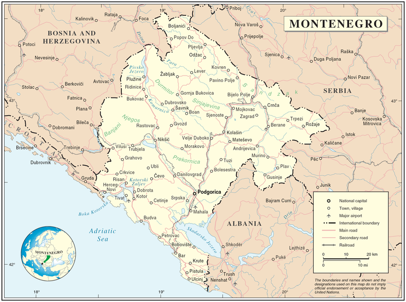
Map of Montenegro
| Descrição | Map of Montenegro | |||
| Data | ||||
| Origem | The Cartographic Section of the United Nations (CSUN) | |||
| Autor | Cartographer of the United Nations | |||
| Permissão (Reutilizar este ficheiro) |
|

Histórico do ficheiro
Clique uma data e hora para ver o ficheiro tal como ele se encontrava nessa altura.
| Data e hora | Miniatura | Dimensões | Utilizador | Comentário | |
|---|---|---|---|---|---|
| atual | 17h03min de 10 de março de 2007 | | 2 427 × 1 807 (1,03 MB) | Minestrone | Map of Montenegro {{Information |Description=Map of Montenegro |Source=The Cartographic Section of the United Nations (CSUN) |Date=2007-03-10 |Author=Cartographer of the United Nations |Permission={{Template:UN map}} and the cartographer of the UN [ |
Utilização local do ficheiro
Não há nenhuma página que use este ficheiro.
Utilização global do ficheiro
As seguintes wikis usam este ficheiro:
- als.wikipedia.org
- ar.wikipedia.org
- avk.wikipedia.org
- be-tarask.wikipedia.org
- bg.wikipedia.org
- cs.wikipedia.org
- cy.wikipedia.org
- de.wikipedia.org
- el.wikipedia.org
- en.wikipedia.org
- fa.wikipedia.org
- fr.wikipedia.org
- gag.wikipedia.org
- gd.wikipedia.org
- hr.wiktionary.org
- ia.wikipedia.org
- incubator.wikimedia.org
- io.wikipedia.org
- ka.wikipedia.org
- la.wikipedia.org
- ms.wikipedia.org
- nl.wikipedia.org
- pl.wikipedia.org
- pl.wiktionary.org
- pnb.wikipedia.org
- ps.wikipedia.org
- rm.wikipedia.org
- roa-tara.wikipedia.org
- ro.wikipedia.org
- ro.wikivoyage.org
- ru.wikipedia.org
Ver mais utilizações globais deste ficheiro.