
Ficheiro:Neu-Anspach.jpg

Dimensões desta antevisão: 800 × 600 píxeis. Outras resoluções: 320 × 240 píxeis | 640 × 480 píxeis | 1 024 × 768 píxeis | 1 280 × 960 píxeis | 2 048 × 1 536 píxeis.
Imagem numa resolução maior (2 048 × 1 536 píxeis, tamanho: 967 kB, tipo MIME: image/jpeg)
|
|
Esta imagem provém do Wikimedia Commons, um acervo de conteúdo livre da Wikimedia Foundation que pode ser utilizado por outros projetos.
|
Descrição do ficheiro
| Descrição |
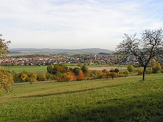
Deutsch: Die Gemeinde Neu-Anspach im Taunus. Fotografiert vom westlichen Rand, südlich des Ortsteils Rod am Berg. Im Hintergrund links der Steinkopf, rechts das Köpperner Tal.
|
| Data | Tirada em 27 de outubro de 2005 |
| Origem | Obra do próprio |
| Autor |
MdE |
| Localização da câmara | | Esta e outras imagens nas suas localizações em: OpenStreetMap |
|---|
Licenciamento
A utilização deste ficheiro é regulada nos termos da licença Creative Commons - Atribuição-CompartilhaIgual 3.0 Não Adaptada.
|

Histórico do ficheiro
Clique uma data e hora para ver o ficheiro tal como ele se encontrava nessa altura.
| Data e hora | Miniatura | Dimensões | Utilizador | Comentário | |
|---|---|---|---|---|---|
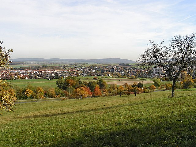
| atual | 11h08min de 1 de agosto de 2006 | | 2 048 × 1 536 (967 kB) | MdE | {{Information |Description=de: Die Stadt Neu-Anspach im Taunus. Fotografiert vom nördlichen Rand der Stadt. Im Hintergrund links der Steinkopf, rechts das Köpperner Tal. en: [[:en:Neu-Anspach|Neu-Ans |
Utilização local do ficheiro
A seguinte página usa este ficheiro:
Utilização global do ficheiro
As seguintes wikis usam este ficheiro:
- azb.wikipedia.org
- de.wikipedia.org
- en.wikipedia.org
- eo.wikipedia.org
- kk.wikipedia.org
- no.wikipedia.org
- pms.wikipedia.org
- ru.wikipedia.org
- sl.wikipedia.org
- uk.wikipedia.org