
Ficheiro:Central and Eastern Europe around 950 AD.png
Sem resolução maior disponível.
Central_and_Eastern_Europe_around_950_AD.png (628 × 525 píxeis, tamanho: 272 kB, tipo MIME: image/png)
|
|
Esta imagem provém do Wikimedia Commons, um acervo de conteúdo livre da Wikimedia Foundation que pode ser utilizado por outros projetos.
|

Descrição do ficheiro
| Descrição |
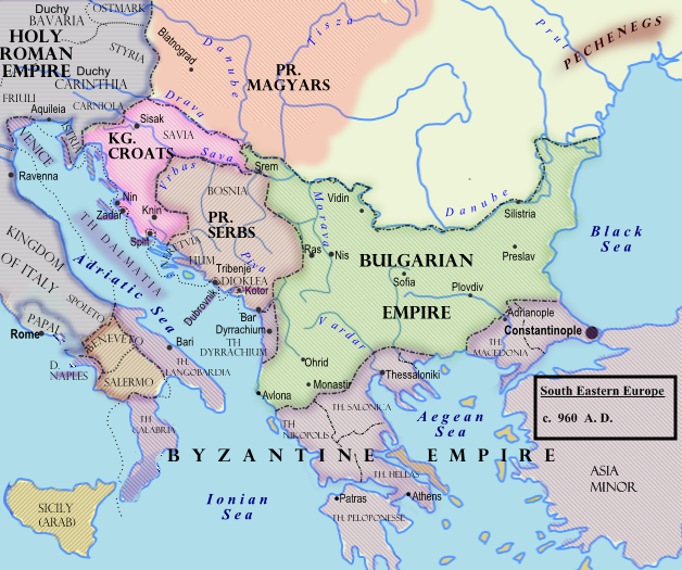
Български: Политическа география на сръбските земи при Чеслав Клонимирович.
English: Southeastern Europe around 950 AD
Español: Europa del Sudeste, hacia 960.
Français : Europe du Sud-Est vers 950 à la mort de Caslav.
Hrvatski: Jugoistočna Europa oko 950. godine.
Română: 950.
Српски / srpski: Оквирни приказ граница на Балкану (око 960. године), крајем Чаславове владавине. |
| Data | 7 de fevereiro de 2009 (data de carregamento original) |
| Origem |
Transferido de en.wikipedia para a wiki Commons.
|
| Autor | Hxseek em Wikipédia em inglês |
![[3]](http://www.lib.utexas.edu/maps/historical/shepherd/europe_byzantine_empires.jpg)
Licenciamento
| Esta obra foi dedicada ao domínio público pelo autor, Hxseek em Wikipédia em inglês, com aplicação em todo o mundo. Nalguns países isto pode não ser legalmente possível; se assim for: Hxseek concede a todos o direito de usar esta obra para qualquer fim, sem quaisquer condições, a menos que tais condições sejam impostas por lei. |
Registo de carregamento original
A página de descrição original está aqui. Todos os nomes de utilizador a seguir referem-se a en.wikipedia.
- 2009-02-07 03:50 Hxseek 628×525× (278873 bytes)
Histórico do ficheiro
Clique uma data e hora para ver o ficheiro tal como ele se encontrava nessa altura.
| Data e hora | Miniatura | Dimensões | Utilizador | Comentário | |
|---|---|---|---|---|---|
| atual | 10h07min de 26 de março de 2009 | | 628 × 525 (272 kB) | Captain-tucker | {{Information |Description={{en|== Licensing: ==}} |Source=Transferred from [http://en.wikipedia.org en.wikipedia] |Date=2009-02-07 (original upload date) |Author=Original uploader was Hxseek at [http://en.wikipedia.org en.wikipedia] | |
Utilização local do ficheiro
As seguintes 2 páginas usam este ficheiro:
Utilização global do ficheiro
As seguintes wikis usam este ficheiro:
- azb.wikipedia.org
- be-tarask.wikipedia.org
- be.wikipedia.org
- bg.wikipedia.org
- el.wikipedia.org
- en.wikipedia.org
- es.wikipedia.org
- et.wikipedia.org
- fi.wikipedia.org
- fr.wikipedia.org
- gl.wikipedia.org
- hu.wikipedia.org
- it.wikipedia.org
- lt.wikipedia.org
- lv.wikipedia.org
- mk.wikipedia.org
- pl.wikipedia.org
- ro.wikipedia.org
- ru.wikipedia.org
- sh.wikipedia.org
- sl.wikipedia.org
- sr.wikipedia.org
- th.wikipedia.org
- uk.wikipedia.org