
Ficheiro:USACE Webbers Falls Lock and Dam.jpg
Dimensões desta antevisão: 400 × 599 píxeis. Outras resoluções: 160 × 240 píxeis | 320 × 480 píxeis | 1 001 × 1 500 píxeis.
Imagem numa resolução maior (1 001 × 1 500 píxeis, tamanho: 580 kB, tipo MIME: image/jpeg)
|
|
Esta imagem provém do Wikimedia Commons, um acervo de conteúdo livre da Wikimedia Foundation que pode ser utilizado por outros projetos.
|
| Descrição |
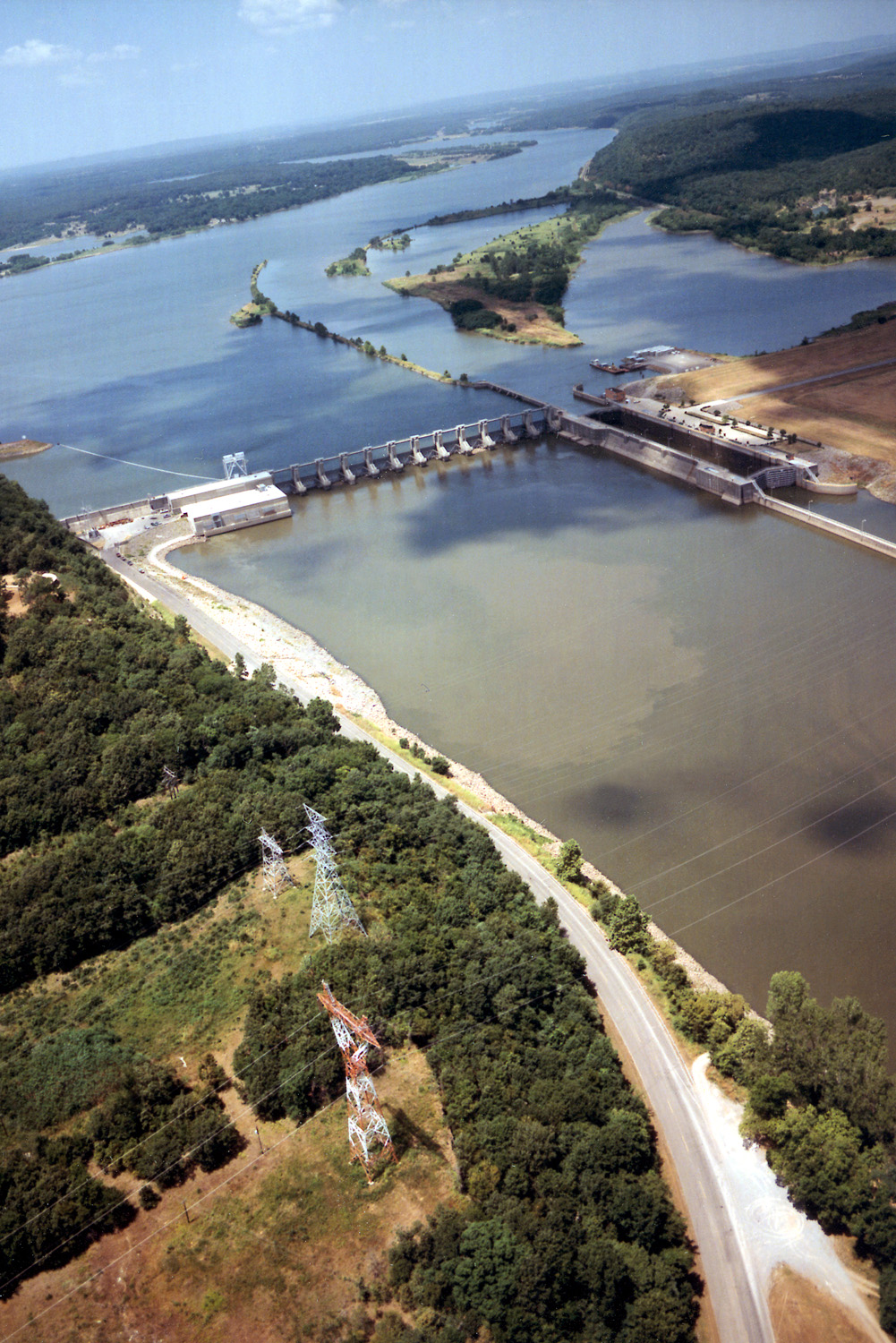
English: Aerial view of Webbers Falls Lock and Dam on the Arkansas River in Muskogee County, Oklahoma, USA. The dam is located about 4 miles (6.4 km) upriver from the town of Webbers Falls and about 62 miles (100 km) (straight line) southeast of Tulsa. The U.S. Army Corps of Engineers maintains the locks and the river channel for barge navigation on the river. View is upriver to the northwest.
Coordinates: 35°33′13.73″N 95°10′9.26″W / 35.5538139°N 95.1692389°W |
|||
| Local | Muskogee County, Oklahoma, USA | |||
| Data | (Caveat: Dates provided by U.S. Army Corps of Engineers Digital Visual Library are not reliable and may be wrong.) | |||
| Origem |
U.S. Army Corps of Engineers Digital Visual Library Image page Image description page Digital Visual Library home page |
|||
| Autor | U.S. Army Corps of Engineers, photographer not specified or unknown | |||
| Permissão (Reutilizar este ficheiro) |
|
Histórico do ficheiro
Clique uma data e hora para ver o ficheiro tal como ele se encontrava nessa altura.
| Data e hora | Miniatura | Dimensões | Utilizador | Comentário | |
|---|---|---|---|---|---|
| atual | 03h15min de 11 de maio de 2007 | | 1 001 × 1 500 (580 kB) | DanMS | {{Information | Description = {{en|Aerial view of Webbers Falls Lock and Dam on the Arkansas River in Muskogee County, Oklahoma, USA. The dam is located about 4 miles (6.4 km) upriver from the town of Webbers Falls and about 62 miles (100 km) (straight |
Utilização local do ficheiro
A seguinte página usa este ficheiro:
Utilização global do ficheiro
As seguintes wikis usam este ficheiro:
- da.wikipedia.org
- en.wikipedia.org
- es.wikipedia.org
- fr.wikipedia.org
- ja.wikipedia.org
- ky.wikipedia.org
- www.wikidata.org
- zh.wikipedia.org