
Ficheiro:Ankara asv2021-10 img04 Anıtkabir.jpg
Dimensões desta antevisão: 800 × 400 píxeis. Outras resoluções: 320 × 160 píxeis | 640 × 320 píxeis | 1 024 × 512 píxeis | 1 280 × 640 píxeis | 2 560 × 1 280 píxeis | 7 594 × 3 797 píxeis.
Imagem numa resolução maior (7 594 × 3 797 píxeis, tamanho: 12,18 MB, tipo MIME: image/jpeg)
|
|
Esta imagem provém do Wikimedia Commons, um acervo de conteúdo livre da Wikimedia Foundation que pode ser utilizado por outros projetos.
|
Descrição do ficheiro
| Descrição |
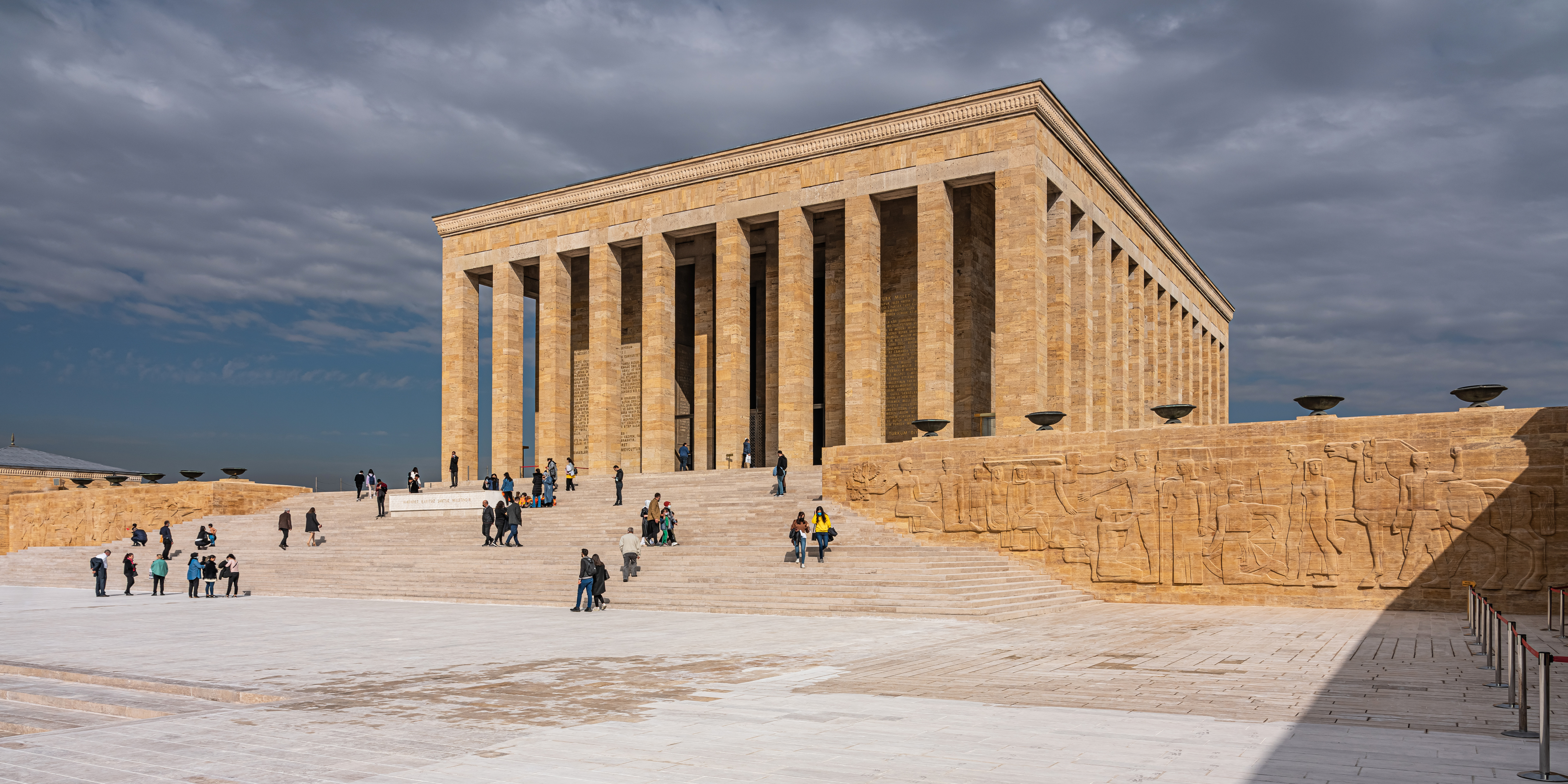
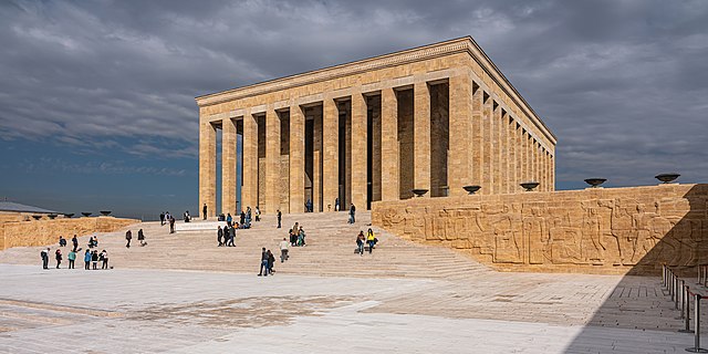
English: Anıtkabir (the mausoleum with Atatürk's tomb) in Ankara, Turkey
Русский: Аныткабир (мавзолей с усыпальницей Ататюрка) в Анкаре, Турция |
||
| Data | |||
| Origem | Obra do próprio | ||
| Autor | A.Savin | ||
| Permissão (Reutilizar este ficheiro) |
.svg) Just attribute the author: «A.Savin, Wikipedia»; if you have questions — Telegram, or e-mail to wikiphotospace@gmail.com..svg) Просто укажите в качестве автора: «А.Савин, Википедия»; если есть вопрос — телеграм, или эл.почта на wikiphotospace@gmail.com. Kennzeichnen Sie einfach als Autor: «A.Savin, Wikipedia»; falls Sie Fragen haben — Telegram, oder E-Mail an wikiphotospace@gmail.com.
Thank you.
|
| Localização da câmara | | Esta e outras imagens nas suas localizações em: OpenStreetMap |
|---|
Licenciamento
| Copyleft: Esta é uma obra de arte livre; pode redistribuí-la e/ou modificá-la nos termos da licença Free Art License. Encontrará um exemplar desta licença no site Copyleft Attitude e noutros sites. |
Histórico do ficheiro
Clique uma data e hora para ver o ficheiro tal como ele se encontrava nessa altura.
| Data e hora | Miniatura | Dimensões | Utilizador | Comentário | |
|---|---|---|---|---|---|
| atual | 05h38min de 1 de fevereiro de 2022 | | 7 594 × 3 797 (12,18 MB) | A.Savin | {{User:A.Savin/F|L=1 |Description= {{en|Anıtkabir (the mausoleum with Atatürk's tomb) in Ankara, Turkey}} {{ru|Аныткабир (мавзолей с усыпальницей Ататюрка) в Анкаре, Турция}} |Year=2021 |Country=Turkey |Month=10 |Day=27}} {{Location}} Category:Taken with Sony ILCE-7RM3 Category:Taken with Sony FE 24-105mm F4 G OSS Category:2021 in Ankara Category:Exterior of Anıtkabir Category:Reliefs in Anıtkabir Category:Stairs in Ankara Category:Clouds and blue sky in Turkey |
Utilização local do ficheiro
As seguintes 4 páginas usam este ficheiro:
Utilização global do ficheiro
As seguintes wikis usam este ficheiro:
- ar.wikipedia.org
- arz.wikipedia.org
- az.wikipedia.org
- ba.wikipedia.org
- be.wikipedia.org
- bg.wikipedia.org
- bn.wikipedia.org
- cs.wikipedia.org
- de.wikipedia.org
- de.wikivoyage.org
- diq.wikipedia.org
- el.wikipedia.org
- en.wikipedia.org
- en.wikivoyage.org
- en.wiktionary.org
- eo.wikipedia.org
- es.wikipedia.org
- et.wikipedia.org
- eu.wikipedia.org
- fa.wikipedia.org
- fi.wikipedia.org
- fr.wikipedia.org
- he.wikipedia.org
- hu.wikipedia.org
- hy.wikipedia.org
- it.wikipedia.org
- ja.wikipedia.org
Ver mais utilizações globais deste ficheiro.