
Ficheiro:Arab League 1971.svg

Dimensões desta antevisão em PNG do ficheiro SVG: 200 × 105 píxeis Outras resoluções: 320 × 168 píxeis | 640 × 336 píxeis | 1 024 × 538 píxeis | 1 280 × 672 píxeis | 2 560 × 1 344 píxeis.
Imagem numa resolução maior (ficheiro SVG, de 200 × 105 píxeis, tamanho: 1,25 MB)
|
|
Esta imagem provém do Wikimedia Commons, um acervo de conteúdo livre da Wikimedia Foundation que pode ser utilizado por outros projetos.
|
Descrição do ficheiro
| Descrição |
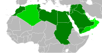
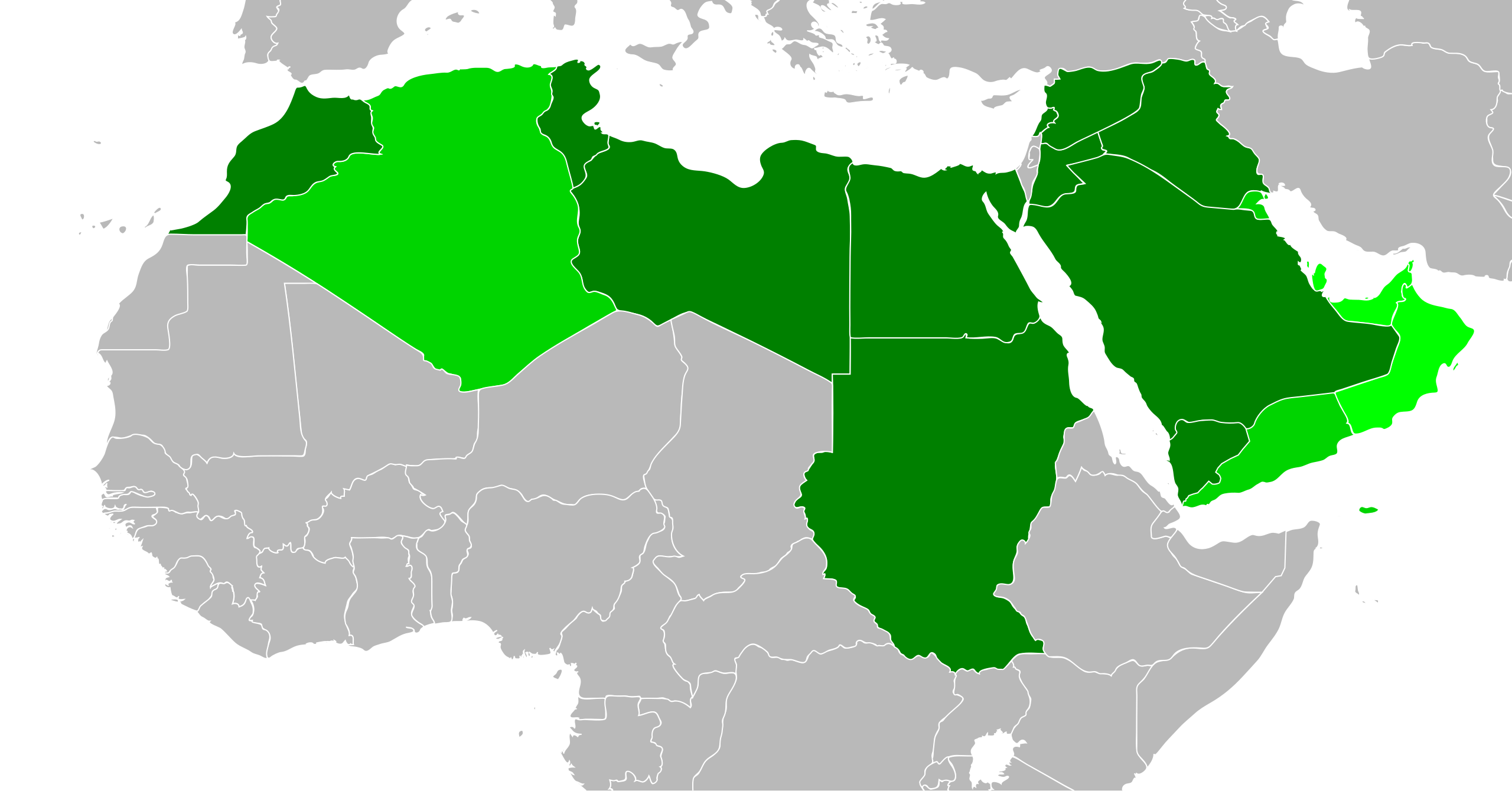
English: Map of the Arab League in 1971. Contemporary borders for states that will join the Arab League, modern borders for other African state. Based on File:BlankMap-World6-Equirectangular.svg, which is released under public domain. SVG file, intended to supersede File:AL1971.PNG. Created with Inkscape. |
| Data | |
| Origem | Self, based on CC 1.0 public domain file (see description) |
| Autor | User:Quintucket |
| Outras versões | File:AL1971.PNG |
Licenciamento
Eu, titular dos direitos de autor desta obra, publico-a com a seguinte licença:
| A utilização deste ficheiro é regulada nos termos Creative Commons - CC0 1.0 Dedicação Universal ao Domínio Público. | |
| A pessoa que associou uma obra a este documento dedicou-a ao domínio público, renunciando a todos os seus direitos sobre a obra em todo o mundo ao abrigo da legislação de direitos de autor, incluindo a todos os direitos legais conexos, na medida permitida por lei. Pode copiar, modificar, distribuir e executar a obra, até com fins comerciais, sem pedir autorização.
|
Histórico do ficheiro
Clique uma data e hora para ver o ficheiro tal como ele se encontrava nessa altura.
| Data e hora | Miniatura | Dimensões | Utilizador | Comentário | |
|---|---|---|---|---|---|
| atual | 19h23min de 28 de dezembro de 2011 | | 200 × 105 (1,25 MB) | Quintucket | Western Sahara border. You see... I made maps for every expansion, but not in order (Don't know if I should upload them, but I made them, then this set showing multiple expansions to replace the ones used on Wikipedia. Thus, when I created the 1971 expa |
| 08h39min de 27 de dezembro de 2011 |  | 200 × 105 (1,25 MB) | Quintucket | {{Information |Description ={{en|1=Map of the Arab League in 1971. Contemporary borders for states that will join the Arab League, modern borders for other African state. Based on File:BlankMap-World6-Equirectangular.svg, which is released under |
Utilização local do ficheiro
A seguinte página usa este ficheiro:
Utilização global do ficheiro
As seguintes wikis usam este ficheiro:
- ar.wikipedia.org
- bn.wikipedia.org
- en.wikipedia.org
- zh.wikipedia.org