
Ficheiro:Greater Croatia 01.png
Dimensões desta antevisão: 663 × 600 píxeis. Outras resoluções: 265 × 240 píxeis | 531 × 480 píxeis | 849 × 768 píxeis | 1 151 × 1 041 píxeis.
Imagem numa resolução maior (1 151 × 1 041 píxeis, tamanho: 153 kB, tipo MIME: image/png)
|
|
Esta imagem provém do Wikimedia Commons, um acervo de conteúdo livre da Wikimedia Foundation que pode ser utilizado por outros projetos.
|
Descrição do ficheiro
| Descrição |
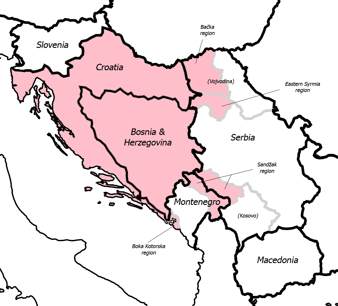
English: Fixed some detail, used overlaid Sandzak, Backa & Syrmium regions so it's much more accurate now. Pink coloring denotes regions claimed by Greater Croatian proponents. Current country borders are black, regional borders (only those that are relevant to the article) are grey.
CommentMap is still wrong:) Croatian-Slovenian border in Istria is 20 kilometars southern that it should be (Umag and Savudrija are in Croatia, hej!) And borders of eastern Srijem are not correct (Zemun and Novi Beograd are part of Srijem, too).
|
| Data | 24 de maio de 2006 (data de carregamento original) |
| Origem | Transferido de en.wikipedia para a wiki Commons. |
| Autor | Dr.Gonzo em Wikipédia em inglês |
| Outras versões |
|


Licenciamento
| Esta obra foi dedicada ao domínio público pelo autor, Dr.Gonzo em Wikipédia em inglês, com aplicação em todo o mundo. Nalguns países isto pode não ser legalmente possível; se assim for: Dr.Gonzo concede a todos o direito de usar esta obra para qualquer fim, sem quaisquer condições, a menos que tais condições sejam impostas por lei. |
Registo de carregamento original
A página de descrição original está aqui. Todos os nomes de utilizador a seguir referem-se a en.wikipedia.
- 2007-03-13 10:42 Dr.Gonzo 1151×1041×8 (156832 bytes) Fixed the Istria border (sorry for that, the blank map I used already had that mistake)
- 2006-05-24 22:25 Dr.Gonzo 1151×1041×8 (154088 bytes) Fixed some detail, used overlayed Sandzak, Backa & Syrmium regions so it's much more accurate now.
- 2006-05-24 19:10 Dr.Gonzo 1151×1041×8 (153078 bytes) First version, self made. Some minor geographical detail may be incorrect. Pink coloring denotes regions claimed by Greater Croatian proponents.
Histórico do ficheiro
Clique uma data e hora para ver o ficheiro tal como ele se encontrava nessa altura.
| Data e hora | Miniatura | Dimensões | Utilizador | Comentário | |
|---|---|---|---|---|---|
| atual | 22h40min de 25 de fevereiro de 2008 | | 1 151 × 1 041 (153 kB) | File Upload Bot (Magnus Manske) | {{BotMoveToCommons|en.wikipedia}} {{Information |Description={{en|Fixed some detail, used overlaid Sandzak, Backa & Syrmium regions so it's much more accurate now. Pink coloring denotes regions claimed by Greater Croatian proponents. Current country bord |
Utilização local do ficheiro
A seguinte página usa este ficheiro:
Utilização global do ficheiro
As seguintes wikis usam este ficheiro:
- ar.wikipedia.org
- bs.wikipedia.org
- cs.wikipedia.org
- de.wikipedia.org
- el.wikipedia.org
- en.wikipedia.org
- id.wikipedia.org
- ja.wikipedia.org
- sh.wikipedia.org
- sr.wikipedia.org
- uk.wikipedia.org
- www.wikidata.org