
Ficheiro:Interstate Highways.svg

Imagem numa resolução maior (ficheiro SVG, de 2 304 × 1 424 píxeis, tamanho: 1,69 MB)
|
|
Esta imagem provém do Wikimedia Commons, um acervo de conteúdo livre da Wikimedia Foundation que pode ser utilizado por outros projetos.
|

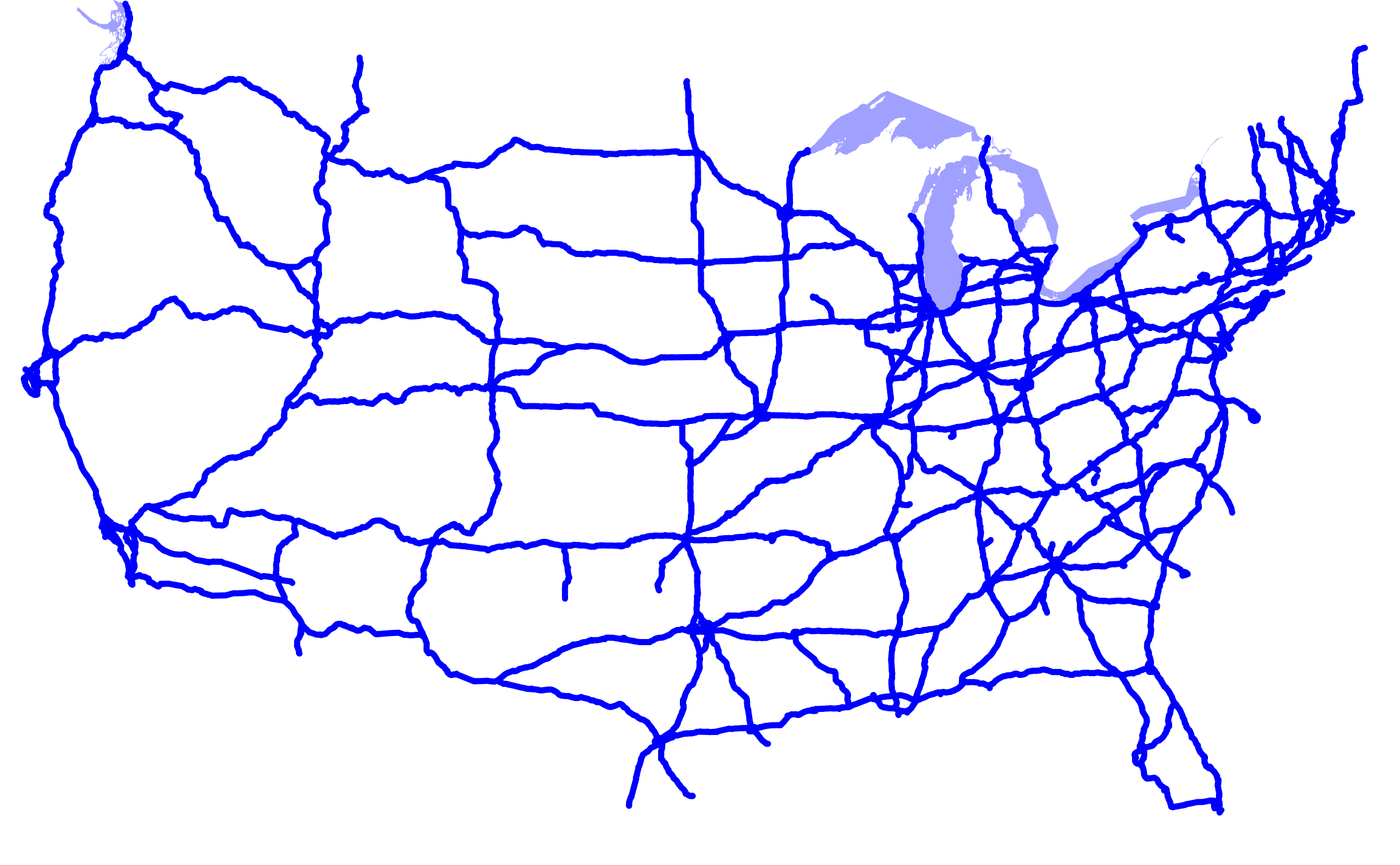
A map of the Interstate Highways in the contiguous United States (not including Hawaii).
Note that this map is missing Interstate 73, Interstate 86, and Interstate 99.
David Benbennick made this map. It uses azimuthal equidistant projection, centered on (-98.58 west, 39.83 north), with data from nationalatlas.gov, specifically roadtrl020.tar.gz. The scale is in hectometers (100 meters). The highways in the SVG file are labelled, so it should be easy to modify it to make locator maps of specific highways. See the talk page for more information on how this map was made.
| Eu, titular dos direitos de autor desta obra, dedico-a ao domínio público, com aplicação em todo o mundo. Nalguns países isto pode não ser legalmente possível; se assim for: Concedo a todos o direito de usar esta obra para qualquer fim, sem quaisquer condições, a menos que tais condições sejam impostas por lei. |
Histórico do ficheiro
Clique uma data e hora para ver o ficheiro tal como ele se encontrava nessa altura.
| Data e hora | Miniatura | Dimensões | Utilizador | Comentário | |
|---|---|---|---|---|---|
| atual | 23h04min de 5 de abril de 2007 | | 2 304 × 1 424 (1,69 MB) | Augiasstallputzer~commonswiki | Setting a srceencompatible size. To print, please download the image and edit the size values in real measures (metric or inch). |
Utilização local do ficheiro
Não há nenhuma página que use este ficheiro.
Utilização global do ficheiro
As seguintes wikis usam este ficheiro:
- no.wikipedia.org