
Ficheiro:Island of Ireland location map Galway.svg

Dimensões desta antevisão em PNG do ficheiro SVG: 481 × 599 píxeis Outras resoluções: 192 × 240 píxeis | 385 × 480 píxeis | 616 × 768 píxeis | 822 × 1 024 píxeis | 1 643 × 2 048 píxeis | 1 450 × 1 807 píxeis.
Imagem numa resolução maior (ficheiro SVG, de 1 450 × 1 807 píxeis, tamanho: 642 kB)
|
|
Esta imagem provém do Wikimedia Commons, um acervo de conteúdo livre da Wikimedia Foundation que pode ser utilizado por outros projetos.
|
| Descrição |
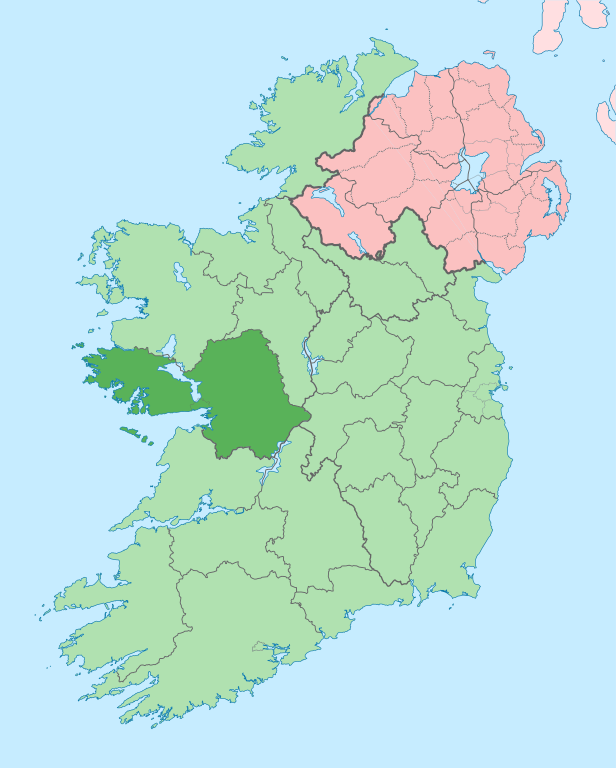
English: The island of Ireland, showing international border between Ireland and Northern Ireland, traditional provinces, traditional counties, and local authority areas in Ireland and Northern Ireland. |
| Data | (UTC) |
| Origem | |
| Autor |
|
| Esta é uma imagem retocada, o que significa que a versão original foi alterada digitalmente. Modificações: Coloured in regions with county of article highlighted. O original pode ser visto aqui: Island of Ireland location map.svg:
|
Eu, titular dos direitos de autor desta obra, publico-a com a seguinte licença:
A utilização deste ficheiro é regulada nos termos da licença Creative Commons - Atribuição-CompartilhaIgual 3.0 Não Adaptada.
- Pode:
- partilhar – copiar, distribuir e transmitir a obra
- recombinar – criar obras derivadas
- De acordo com as seguintes condições:
- atribuição – Tem de fazer a devida atribuição da autoria, fornecer uma hiperligação para a licença e indicar se foram feitas alterações. Pode fazê-lo de qualquer forma razoável, mas não de forma a sugerir que o licenciador o apoia ou subscreve o seu uso da obra.
- partilha nos termos da mesma licença – Se remisturar, transformar ou ampliar o conteúdo, tem de distribuir as suas contribuições com a mesma licença ou uma licença compatível com a original.
Registo de carregamento original
This image is a derivative work of the following images:
- File:Island_of_Ireland_location_map.svg licensed with Cc-by-sa-3.0
- 2010-03-06T20:43:33Z Rannpháirtí anaithnid 1450x1807 (679207 Bytes) Fix incorrectly coloured isands.
- 2010-03-03T22:19:29Z Rannpháirtí anaithnid 1450x1807 (679744 Bytes) {{Information |Description={{de|Positionskarte von [[:de:Irland|Irland]]}} Quadratische Plattkarte, N-S-Streckung 170 %. Geographische Begrenzung der Karte: * N: 55.6° N * S: 51.2° N * W: 11.0° W * O: 5.0° W {{en|Location
Carregada com derivativeFX
Histórico do ficheiro
Clique uma data e hora para ver o ficheiro tal como ele se encontrava nessa altura.
| Data e hora | Miniatura | Dimensões | Utilizador | Comentário | |
|---|---|---|---|---|---|
| atual | 14h00min de 28 de junho de 2020 | | 1 450 × 1 807 (642 kB) | Chipmunkdavis | Per the Local Government Reform Act 2014, joining both Tipperarys and both Waterfords (and removing Limerick City code). Colouring in islands, cleaning up and grouping code to remove stray objects and show Galway and Lough Ree. |
| 00h44min de 19 de julho de 2010 |  | 1 450 × 1 807 (816 kB) | Mabuska | {{Information |Description={{en|The island of Ireland, showing international border between Northern Ireland and Republic of Ireland, traditional provinces, traditional counties, and local authority areas in the Republic of Ireland and Northern Ireland.}} |
Utilização local do ficheiro
A seguinte página usa este ficheiro:
Utilização global do ficheiro
As seguintes wikis usam este ficheiro:
- ar.wikipedia.org
- ast.wikipedia.org
- bg.wikipedia.org
- ca.wikipedia.org
- Comtat de Galway
- Galway
- Athenry
- An Spidéal
- Tuam
- Kinvara
- Plantilla:Comtat Galway
- Ballinasloe
- Gort
- Loughrea
- Baile na hAbhann
- Casla (Irlanda)
- Béal an Daingin
- Camus (Galway)
- An Cheathrú Rua
- Baile an Chláir
- Bearna
- Ros Muc
- An Fhairche
- Corr na Móna
- Leitir Móir
- Leitir Mealláin
- Maigh Cuilinn
- Ros an Mhíl
- Indreabhán
- Cill Chiaráin
- Cill Rónáin
- Na Forbacha
- Clifden
- New Inn (Galway)
- Aughrim (Galway)
- Baile an Mhuilinn (Galway)
- ceb.wikipedia.org
- cs.wikipedia.org
- en.wikipedia.org
Ver mais utilizações globais deste ficheiro.