
Ficheiro:Map of Indiana highlighting Brown County.svg

Dimensões desta antevisão em PNG do ficheiro SVG: 391 × 599 píxeis Outras resoluções: 156 × 240 píxeis | 313 × 480 píxeis | 501 × 768 píxeis | 668 × 1 024 píxeis | 1 337 × 2 048 píxeis | 2 887 × 4 423 píxeis.
Imagem numa resolução maior (ficheiro SVG, de 2 887 × 4 423 píxeis, tamanho: 56 kB)
|
|
Esta imagem provém do Wikimedia Commons, um acervo de conteúdo livre da Wikimedia Foundation que pode ser utilizado por outros projetos.
|
Descrição do ficheiro
| Descrição |
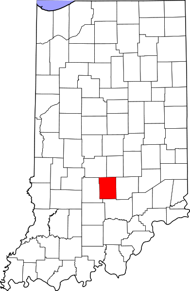
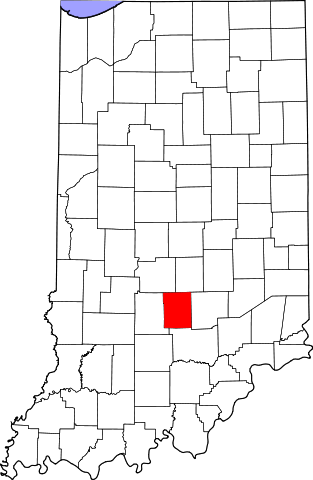
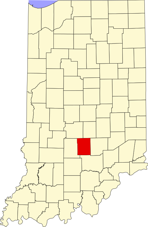
English: This is a locator map showing Brown County in Indiana. For more information, see Commons:United States county locator maps. |
| Data | |
| Origem |
Obra do próprio: English: The maps use data from nationalatlas.gov, specifically countyp020.tar.gz on the Raw Data Download page. The maps also use state outline data from statesp020.tar.gz. The Florida maps use hydrogm020.tar.gz to display Lake Okeechobee. |
| Autor | David Benbennick |
Licenciamento
| Eu, titular dos direitos de autor desta obra, dedico-a ao domínio público, com aplicação em todo o mundo. Nalguns países isto pode não ser legalmente possível; se assim for: Concedo a todos o direito de usar esta obra para qualquer fim, sem quaisquer condições, a menos que tais condições sejam impostas por lei. |
Histórico do ficheiro
Clique uma data e hora para ver o ficheiro tal como ele se encontrava nessa altura.
| Data e hora | Miniatura | Dimensões | Utilizador | Comentário | |
|---|---|---|---|---|---|
| atual | 12h09min de 12 de fevereiro de 2006 | | 2 887 × 4 423 (56 kB) | David Benbennick | {{subst:User:Dbenbenn/clm|county=Brown County|state=Indiana}} |
Utilização local do ficheiro
A seguinte página usa este ficheiro:
Utilização global do ficheiro
As seguintes wikis usam este ficheiro:
- ar.wikipedia.org
- azb.wikipedia.org
- bg.wikipedia.org
- bpy.wikipedia.org
- cdo.wikipedia.org
- ceb.wikipedia.org
- ce.wikipedia.org
- cy.wikipedia.org
- de.wikipedia.org
- en.wikipedia.org
- List of counties in Indiana
- Brown County, Indiana
- Nashville, Indiana
- Gnaw Bone, Indiana
- Weed Patch Hill
- Knobstone Escarpment
- Belmont, Indiana
- Beanblossom, Indiana
- Hamblen Township, Brown County, Indiana
- Jackson Township, Brown County, Indiana
- Van Buren Township, Brown County, Indiana
- Washington Township, Brown County, Indiana
- Template:Brown County, Indiana
- Template:BrownCountyIN-geo-stub
- Christiansburg, Indiana
- Cornelius, Indiana
- Elkinsville, Indiana
- Fruitdale, Indiana
- Gatesville, Indiana
- Mount Liberty, Indiana
- Needmore, Brown County, Indiana
- Pikes Peak, Indiana
- Spearsville, Indiana
- Stone Head, Indiana
- Story, Indiana
- Trevlac, Indiana
- Peoga, Indiana
Ver mais utilizações globais deste ficheiro.