
Ficheiro:Map of USA MD.svg

Dimensões desta antevisão em PNG do ficheiro SVG: 286 × 186 píxeis Outras resoluções: 320 × 208 píxeis | 640 × 416 píxeis | 1 024 × 666 píxeis | 1 280 × 832 píxeis | 2 560 × 1 665 píxeis.
Imagem numa resolução maior (ficheiro SVG, de 286 × 186 píxeis, tamanho: 167 kB)
|
|
Esta imagem provém do Wikimedia Commons, um acervo de conteúdo livre da Wikimedia Foundation que pode ser utilizado por outros projetos.
|
Clickable version
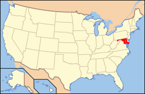
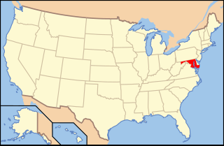
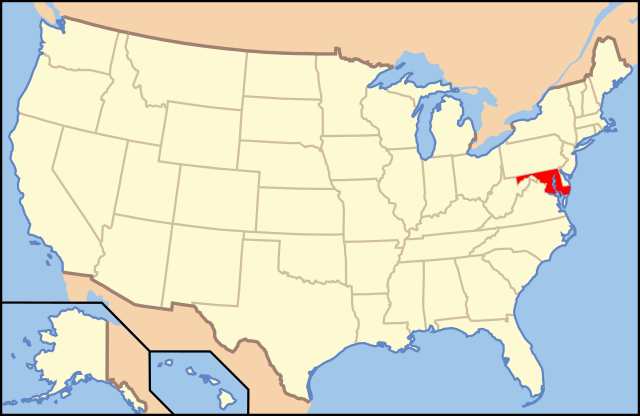
| Descrição | Map of USA with Maryland highlighted | ||||||||
| Data | see file history below. | ||||||||
| Origem | Obra do próprio (Texto original: “own work by uploader, Obra própria, baseada em: Map of USA without state names.svg”) | ||||||||
| Autor |
This version: uploader Base versions this one is derived from: originally created by Wapcaplet |
||||||||
| Permissão (Reutilizar este ficheiro) |
A utilização deste ficheiro é regulada nos termos da licença Creative Commons - Atribuição 2.0 Genérica.
|
||||||||
| Outras versões | Map of USA with state names.svg | ||||||||
| SVG desenvolvimento | O código-fonte desta imagem SVG é válido. Esta carta geográfica foi criada com o Inkscape. |

Histórico do ficheiro
Clique uma data e hora para ver o ficheiro tal como ele se encontrava nessa altura.
| Data e hora | Miniatura | Dimensões | Utilizador | Comentário | |
|---|---|---|---|---|---|
| atual | 13h42min de 1 de novembro de 2012 | | 286 × 186 (167 kB) | Kmusser | remove VA portion of eastern shore |
| 09h06min de 26 de abril de 2008 |  | 286 × 186 (167 kB) | Rub1615~commonswiki | Reverted to version as of 07:11, 9 June 2006 | |
| 15h32min de 23 de abril de 2008 |  | 286 × 186 (183 kB) | Rfc1394 | Add an inset to the map enlarging the focus area to make it easier to see the designated state. | |
| 07h11min de 9 de junho de 2006 |  | 286 × 186 (167 kB) | Huebi~commonswiki | {{Information| |Description=Map of USA with Maryland highlighted |other_versions=image:Map of USA with state names.svg }} Category:Maps of the United States Category:Maps of Maryland Category:SVG maps {{GFDL-en}}{{cc-by-2.0}}{{cc-by-sa- |
Utilização local do ficheiro
As seguintes 6 páginas usam este ficheiro:
Utilização global do ficheiro
As seguintes wikis usam este ficheiro:
- af.wikipedia.org
- ang.wikipedia.org
- an.wikipedia.org
- arc.wikipedia.org
- ar.wikipedia.org
- arz.wikipedia.org
- ay.wikipedia.org
- az.wiktionary.org
- bg.wikipedia.org
- bi.wikipedia.org
- bo.wikipedia.org
- bpy.wikipedia.org
- bxr.wikipedia.org
- ca.wikipedia.org
- ce.wikipedia.org
- cs.wikipedia.org
- da.wikipedia.org
- Maryland
- Annapolis
- Baltimore
- Towson (Maryland)
- Worcester County (Maryland)
- Allegany County (Maryland)
- Anne Arundel County
- Denton (Maryland)
- Frederick (Maryland)
- Oakland (Maryland)
- Cumberland (Maryland)
- Sharpsburg (Maryland)
- Hagerstown (Maryland)
- La Plata (Maryland)
- Rockville (Maryland)
- Baltimore County
- Frederick County (Maryland)
Ver mais utilizações globais deste ficheiro.