
Ficheiro:Markagunt Plateau.jpg
Sem resolução maior disponível.
Markagunt_Plateau.jpg (640 × 431 píxeis, tamanho: 96 kB, tipo MIME: image/jpeg)
|
|
Esta imagem provém do Wikimedia Commons, um acervo de conteúdo livre da Wikimedia Foundation que pode ser utilizado por outros projetos.
|
| Descrição |
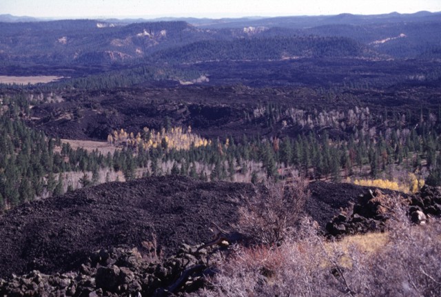
Black Rock Desert volcanic field — Markagunt Plateau.
|
|||
| Data | ||||
| Origem | http://www.volcano.si.edu/world/volcano.cfm?vnum=1207-04-&volpage=photos&photo=045096 | |||
| Autor | Lee Siebert (Smithsonian Institution) | |||
| Permissão (Reutilizar este ficheiro) |
|
Histórico do ficheiro
Clique uma data e hora para ver o ficheiro tal como ele se encontrava nessa altura.
| Data e hora | Miniatura | Dimensões | Utilizador | Comentário | |
|---|---|---|---|---|---|
| atual | 00h44min de 29 de janeiro de 2011 | | 640 × 431 (96 kB) | Michael Metzger | {{Information |Description=Blocky unvegetated lava flows known as the Black Rock Desert extend from near Miller Knoll to the SE. These flows, which also extend NE to near Panguitch Lake, are among the youngest features of the Markagunt Plateau volcanic fi |
Utilização local do ficheiro
Não há nenhuma página que use este ficheiro.
Utilização global do ficheiro
As seguintes wikis usam este ficheiro:
- ceb.wikipedia.org
- de.wikipedia.org
- en.wikipedia.org
- he.wikipedia.org
- ms.wikipedia.org
- no.wikipedia.org
- ru.wikipedia.org
- www.wikidata.org