
Ficheiro:ScotlandHighlands.png
Sem resolução maior disponível.
ScotlandHighlands.png (200 × 230 píxeis, tamanho: 4 kB, tipo MIME: image/png)
|
|
Esta imagem provém do Wikimedia Commons, um acervo de conteúdo livre da Wikimedia Foundation que pode ser utilizado por outros projetos.
|
Descrição do ficheiro
| Descrição |
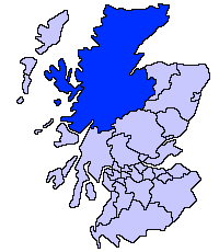
English: Highland unitary council |
| Origem | |
| Autor | Slightly edited version of a map drawn by Morwen |

|
File:ScotlandHighlandCouncil.svg é uma versão vetorial deste ficheiro. Ela deve ser usada em vez desta imagem em formato raster, se não for de qualidade inferior.
File:ScotlandHighlands.png → File:ScotlandHighlandCouncil.svg
Para mais informações, consulte Ajuda:SVG. |
 |
Licenciamento

|
É concedida permissão para copiar, distribuir e/ou modificar este documento nos termos da Licença de Documentação Livre GNU, versão 1.2 ou qualquer versão posterior publicada pela Free Software Foundation; sem Secções Invariantes, sem textos de Capa e sem textos de Contra-Capa. É incluída uma cópia da licença na secção intitulada GNU Free Documentation License. |
| A utilização deste ficheiro é regulada nos termos da licença Creative Commons - Atribuição-CompartilhaIgual 3.0 Não Adaptada. | ||
| ||
| Esta marca de licenciamento foi adicionada a este ficheiro durante a atualização da licença GFDL. |
Histórico do ficheiro
Clique uma data e hora para ver o ficheiro tal como ele se encontrava nessa altura.
| Data e hora | Miniatura | Dimensões | Utilizador | Comentário | |
|---|---|---|---|---|---|
| atual | 21h36min de 17 de maio de 2005 | | 200 × 230 (4 kB) | Voyager | Highland unitary council Slightly edited version of a map drawn by Morwen {{GFDL}} Category:Maps of Scottish unitary councils |
Utilização local do ficheiro
As seguintes 2 páginas usam este ficheiro:
Utilização global do ficheiro
As seguintes wikis usam este ficheiro:
- ast.wikipedia.org
- be.wikipedia.org
- bg.wikipedia.org
- br.wikipedia.org
- cy.wikipedia.org
- da.wikipedia.org
- en.wikipedia.org
- Caithness
- Skye and Lochalsh
- Highland Council wards and councillors 2003 to 2007
- Highland Council wards and councillors 1999 to 2003
- Highland Council wards created in 2007
- Highland Council wards 1999 to 2007
- Highland Council wards 1995 to 1999
- Category:Scotland articles missing geocoordinate data
- Category:Highland articles missing geocoordinate data
- Wikipedia:GLAM/SLIC/Library Partners
- Highland Council Wards in 2017
- eu.wikipedia.org
- Inverness
- Highland
- Eskoziako Lur Garaiak
- Fort William (Eskozia)
- Eilean Donan
- Lankide:Euskaldunaa
- Kyle of Lochalsh
- Ullapool
- Nairn
- Portree
- Broadford (Eskozia)
- John o' Groats
- Kingussie
- Aviemore
- Kyleakin
- Glenfinnan
- Dornoch
- Thurso (Eskozia)
- Txantiloi:Highland
- Alness
- Brora
- Dingwall
- Fortrose
- Grantown-on-Spey
- Invergordon
- Inverlochy (Highland)
- Mallaig
- Tain
- Wick (Caithness)
- Abernethy and Kincardine
- Achnahannet (Strathspey)
- Advie
- Alvie
Ver mais utilizações globais deste ficheiro.