
Ficheiro:Stony Point State Park.jpg
Imagem numa resolução maior (3 591 × 2 539 píxeis, tamanho: 3,16 MB, tipo MIME: image/jpeg)
|
|
Esta imagem provém do Wikimedia Commons, um acervo de conteúdo livre da Wikimedia Foundation que pode ser utilizado por outros projetos.
|
|
Esta é uma imagem de um sítio ou edifício atualmente classificado no Registo Nacional de Lugares Históricos dos Estados Unidos da América. O seu número de referência é 66000567. |
| Descrição |
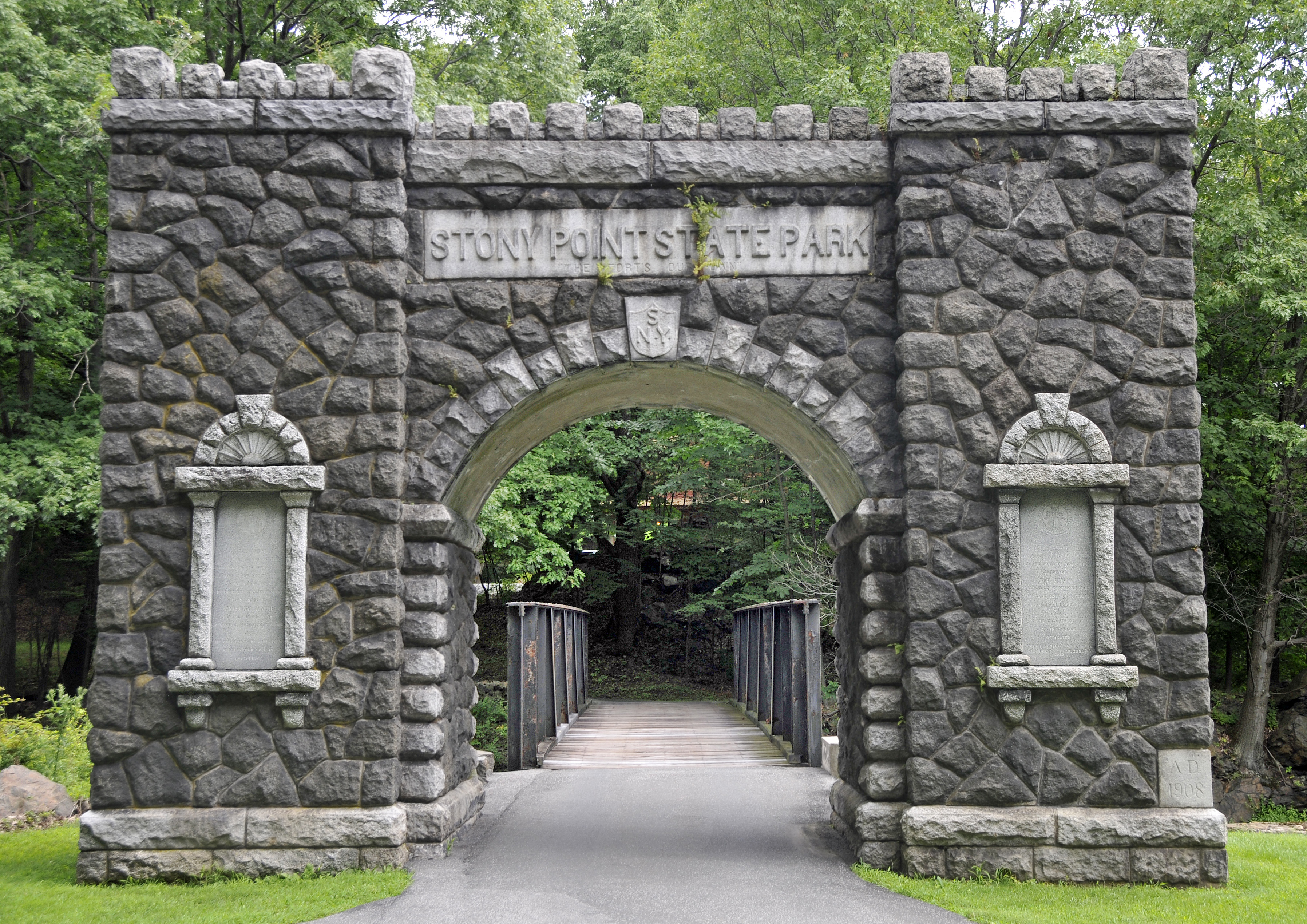
Visit the site of the Battle of Stony Point, one of the last major Revolutionary War battles in the northeastern colonies. This is where Brigadier General Anthony Wayne led his corps of Continental Light Infantry in a daring midnight attack on the British, seizing the site's fortifications and taking the British garrison as prisoners on July 16, 1779. By the late 1770s, the war had been raging for four years and both sides were eager for a conclusion. Sir Henry Clinton, commander of the British forces in America, attempted to coerce General George Washington into one decisive battle to control the Hudson River. As part of his strategy, Clinton fortified Stony Point. Washington devised a plan for Wayne to lead an attack on the fort. Armed with bayonets only, the infantry captured the fort in short order, ending British control of the river. The site features a museum, which offers exhibits on the battle and the 1826 Stony Point Lighthouse, as well as interpretive programs, such as reenactments highlighting 18th century military life, cannon and musket firings, cooking demonstrations, and children's activities. source: State of New York |
||
| Data | |||
| Origem | originally posted to Flickr as Entrance to Stony Point State Park | ||
| Autor | Tony | ||
| Permissão (Reutilizar este ficheiro) |
A utilização deste ficheiro é regulada nos termos da licença Creative Commons - Atribuição 2.0 Genérica.
|
| Localização do objecto | | Esta e outras imagens nas suas localizações em: OpenStreetMap |
|---|
Histórico do ficheiro
Clique uma data e hora para ver o ficheiro tal como ele se encontrava nessa altura.
| Data e hora | Miniatura | Dimensões | Utilizador | Comentário | |
|---|---|---|---|---|---|
| atual | 00h36min de 3 de setembro de 2008 | | 3 591 × 2 539 (3,16 MB) | Flickr upload bot | Uploaded from http://flickr.com/photo/22714323@N06/2754499034 using Flickr upload bot |
Utilização local do ficheiro
A seguinte página usa este ficheiro:
Utilização global do ficheiro
As seguintes wikis usam este ficheiro:
- ceb.wikipedia.org
- de.wikipedia.org
- en.wikipedia.org
- en.wikivoyage.org
- es.wikipedia.org
- fr.wikipedia.org
- ja.wikipedia.org
- www.wikidata.org
- zh.wikipedia.org