
Ficheiro:Un-guatemala.png
Imagem numa resolução maior (2 493 × 2 947 píxeis, tamanho: 1,8 MB, tipo MIME: image/png)
|
|
Esta imagem provém do Wikimedia Commons, um acervo de conteúdo livre da Wikimedia Foundation que pode ser utilizado por outros projetos.
|
| This image is a map derived from a United Nations map.
Unless stated otherwise, UN maps are to be considered in the public domain. This applies worldwide. UN maps are, in principle, open source material and you can use them in your work or for making your own map. UN requests however that you delete the UN name, logo and reference number upon any modification to the map. Content of your map will be your responsibility. You can state in your publication, if you wish, something like: based on UN map … (map name, map number, revision number and date). See: Geospatial Information Section. And: Geospatial, location data for a better world. |
 |
| Descrição |
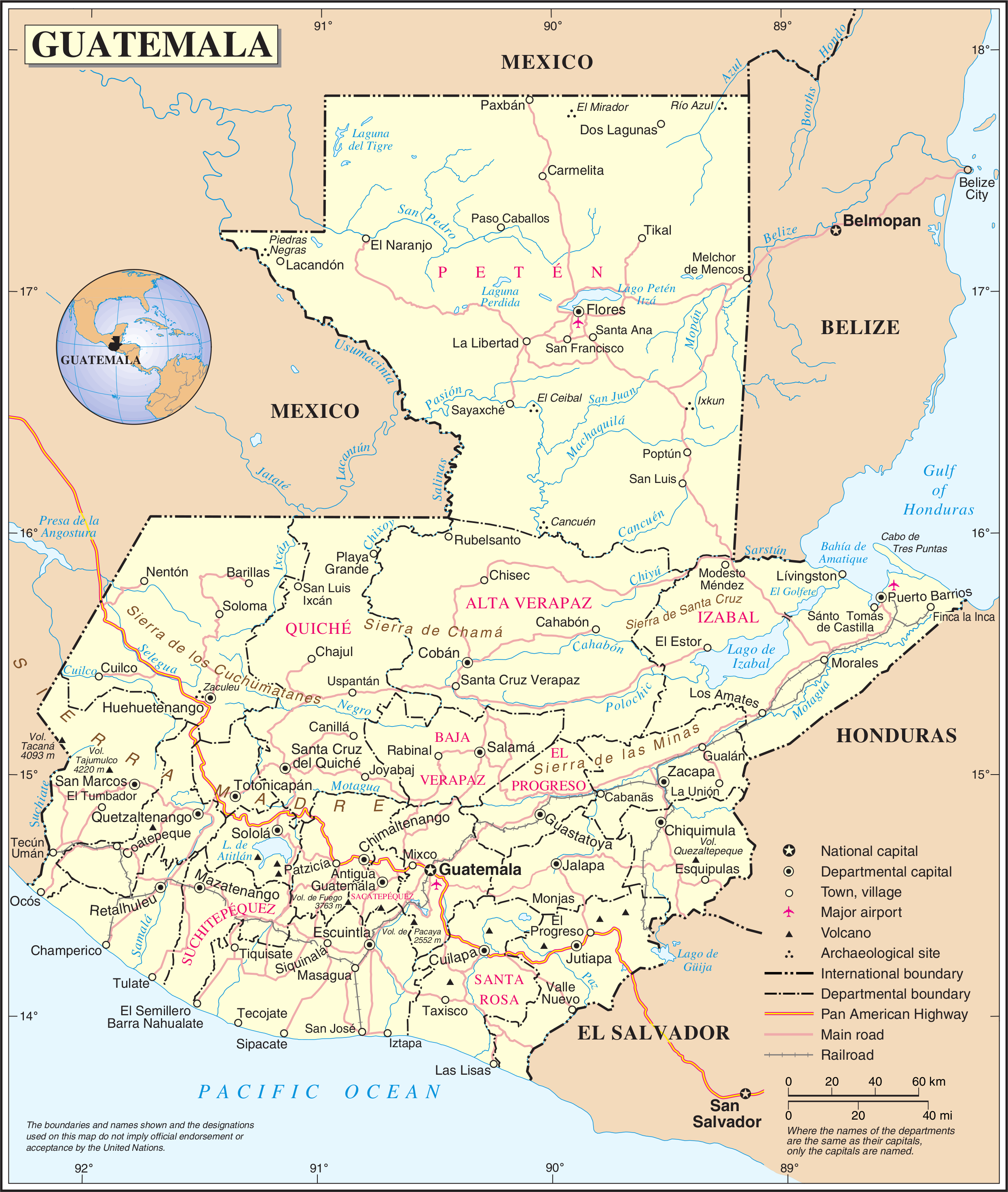
English: Political map of Guatemala generated by the United Nations. |
| Data | |
| Origem | United Nations Geospatial Information Section |
| Autor | United Nations Department of Peacekeeping Operations Cartographic Section |
Histórico do ficheiro
Clique uma data e hora para ver o ficheiro tal como ele se encontrava nessa altura.
| Data e hora | Miniatura | Dimensões | Utilizador | Comentário | |
|---|---|---|---|---|---|
| atual | 01h04min de 24 de outubro de 2007 | | 2 493 × 2 947 (1,8 MB) | Jeroen | {{UN map}} Category:Maps of Guatemala |
Utilização local do ficheiro
Não há nenhuma página que use este ficheiro.
Utilização global do ficheiro
As seguintes wikis usam este ficheiro:
- af.wikipedia.org
- ar.wikipedia.org
- be-tarask.wikipedia.org
- ckb.wikipedia.org
- el.wikipedia.org
- en.wikipedia.org
- Geography of Guatemala
- List of places in Guatemala
- Carlos Castillo Armas
- 1954 Guatemalan coup d'état
- Water supply and sanitation in Guatemala
- Outline of Guatemala
- Guatemala
- List of rivers of Guatemala
- Index of Guatemala-related articles
- Water resources management in Guatemala
- United Nations Security Council Resolution 1094
- User:Nlyemica/sandbox
- es.wikipedia.org
- fa.wikipedia.org
- fi.wikipedia.org
- gom.wikipedia.org
- id.wikipedia.org
- kbp.wikipedia.org
- kn.wikipedia.org
- lez.wikipedia.org
- mzn.wikipedia.org
- nl.wikipedia.org
- pl.wiktionary.org
- ro.wikipedia.org
- ru.wikipedia.org
- sl.wikipedia.org
- ta.wikipedia.org
- te.wikipedia.org
- to.wikipedia.org
- uk.wikipedia.org
- uk.wiktionary.org
Ver mais utilizações globais deste ficheiro.