
Ficheiro:Un-nepal.png

Imagem numa resolução maior (3 038 × 2 257 píxeis, tamanho: 1,56 MB, tipo MIME: image/png)
|
|
Esta imagem provém do Wikimedia Commons, um acervo de conteúdo livre da Wikimedia Foundation que pode ser utilizado por outros projetos.
|
Descrição do ficheiro
| Descrição |
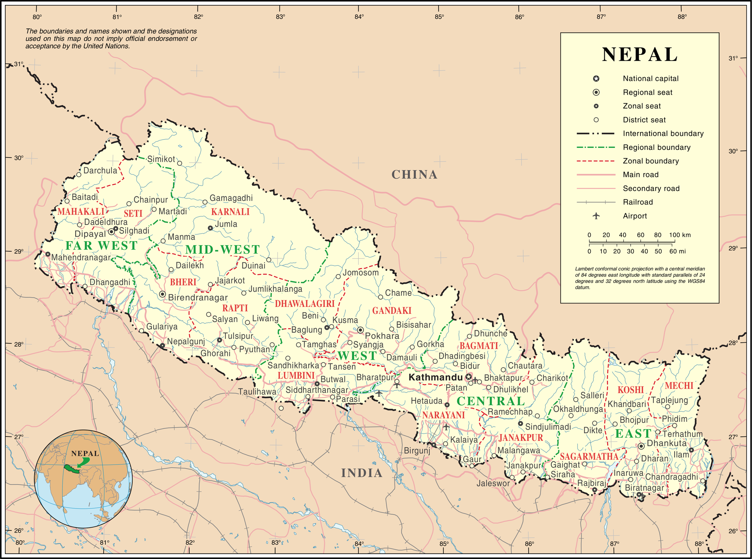
English: Map of Nepal highlighting development regions (green) and administrative zones (red), both disestablished in 2015 |
|||
| Data | antes de 25 de outubro de 2007 | |||
| Origem | United Nations | |||
| Autor | Desconhecido | |||
| Permissão (Reutilizar este ficheiro) |
|

Histórico do ficheiro
Clique uma data e hora para ver o ficheiro tal como ele se encontrava nessa altura.
| Data e hora | Miniatura | Dimensões | Utilizador | Comentário | |
|---|---|---|---|---|---|
| atual | 01h36min de 24 de outubro de 2007 | | 3 038 × 2 257 (1,56 MB) | Jeroen | {{UN map}} Category:Maps of Nepal |
Utilização local do ficheiro
Não há nenhuma página que use este ficheiro.
Utilização global do ficheiro
As seguintes wikis usam este ficheiro:
- af.wikipedia.org
- az.wikipedia.org
- ba.wikipedia.org
- bh.wikipedia.org
- ca.wikipedia.org
- de.wikipedia.org
- en.wikipedia.org
- fi.wikipedia.org
- fr.wikipedia.org
- hyw.wikipedia.org
- ja.wikipedia.org
- krc.wikipedia.org
- nl.wikipedia.org
- pap.wikipedia.org
- pcd.wikipedia.org
- pl.wiktionary.org
- roa-rup.wikipedia.org
- ru.wikipedia.org
- sco.wikipedia.org
- sl.wikipedia.org
- ta.wikipedia.org
- th.wikipedia.org
- tr.wikipedia.org
- uk.wikipedia.org
- ur.wikipedia.org
- www.wikidata.org
- xmf.wikipedia.org