
Ficheiro:Germany adm location map.svg

Imagem numa resolução maior (ficheiro SVG, de 1 073 × 1 272 píxeis, tamanho: 643 kB)
|
|
Esta imagem provém do Wikimedia Commons, um acervo de conteúdo livre da Wikimedia Foundation que pode ser utilizado por outros projetos.
|
Descrição do ficheiro
| Descrição |
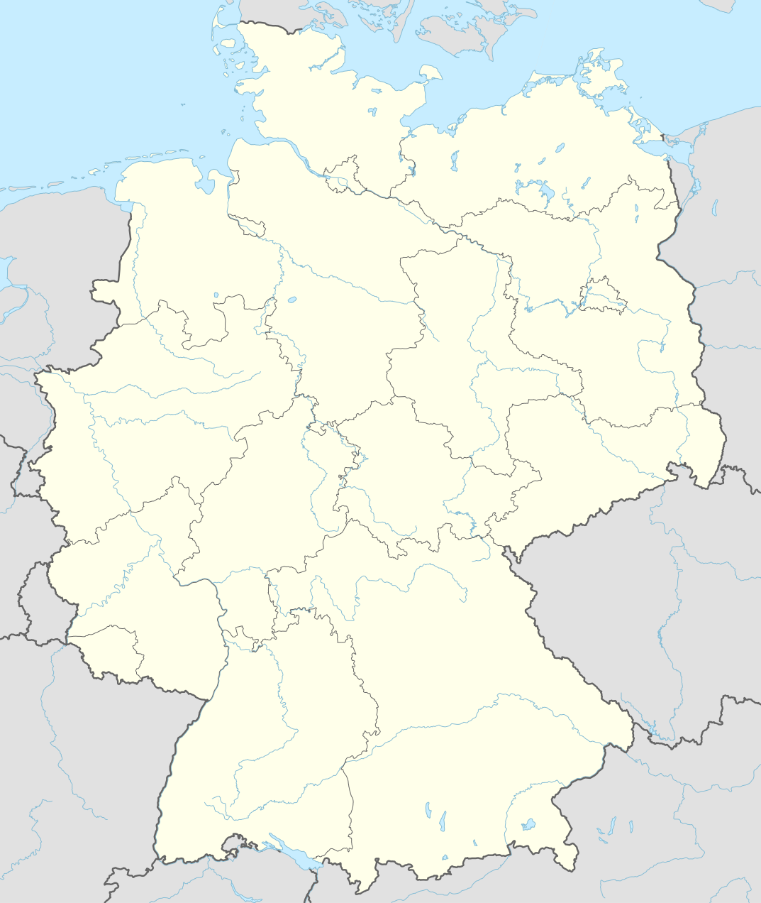
Deutsch: Positionskarte von Deutschland
English: Location map of Germany
|
||||||||||||
| Data | |||||||||||||
| Origem |
Obra própria, usando:
|
||||||||||||
| Autor | NordNordWest | ||||||||||||
| SVG desenvolvimento | O código-fonte desta imagem SVG é válido. Esta carta geográfica foi criada com o Adobe Illustrator por NordNordWest Esta carta geográfica SVG utiliza texto incorporado que pode ser facilmente traduzido usando um editor de texto.
|
||||||||||||

Licenciamento
Usage of this file with:

explanatory notes: Legally binding is only the full legalcode. For a free usage I recommend to respect the following licence conditions:
1. Provide my name as given above: NordNordWest,
2. a copy of, or the URI for, the applicable license: https://creativecommons.org/licenses/by-sa/3.0/de/legalcode,
3. the title of the work,
4. in the case of an adaptation, a credit identifying the use of the work in the adaptation.
This license and the rights granted hereunder will terminate automatically upon any breach by you of the terms of this license. Any of the above conditions can be waived if you get permission from the copyright holder. If you have questions or wish differing conditions, please contact me through nnwest or my discussion page ![]() t-online.de
t-online.de
- Pode:
- partilhar – copiar, distribuir e transmitir a obra
- recombinar – criar obras derivadas
- De acordo com as seguintes condições:
- atribuição – Tem de fazer a devida atribuição da autoria, fornecer uma hiperligação para a licença e indicar se foram feitas alterações. Pode fazê-lo de qualquer forma razoável, mas não de forma a sugerir que o licenciador o apoia ou subscreve o seu uso da obra.
- partilha nos termos da mesma licença – Se remisturar, transformar ou ampliar o conteúdo, tem de distribuir as suas contribuições com a mesma licença ou uma licença compatível com a original.

Histórico do ficheiro
Clique uma data e hora para ver o ficheiro tal como ele se encontrava nessa altura.
| Data e hora | Miniatura | Dimensões | Utilizador | Comentário | |
|---|---|---|---|---|---|
| atual | 17h46min de 15 de setembro de 2014 | | 1 073 × 1 272 (643 kB) | NordNordWest | == {{int:filedesc}} == {{Information |Description= {{de|1=Positionskarte von Deutschland}} {{en|1=Location map of Germany}} {{Location map series N |top=55.1 |bottom=47.2 |left=5.5 |right=15.5 }} |Source={{Own using}} * United States National Imagery a... |
Utilização local do ficheiro
A seguinte página usa este ficheiro:
Utilização global do ficheiro
As seguintes wikis usam este ficheiro:
- af.wikipedia.org
- Heiligendamm
- Lughawe Frankfurt
- Züsedom
- Breinigerberg
- Passau
- Berlyn-Brandenburg Internasionale Lughawe
- Caputh
- Tempelhof-lughawe
- Brobergen
- Bayreuth
- Bimmen
- FIFA Sokker-Wêreldbekertoernooi in 2006
- FIFA Sokker-Konfederasiebeker in 2005
- Kronberg im Taunus
- Eschborn
- Schwalbach am Taunus
- Steinstücken
- Eltville am Rhein
- Bad Homburg vor der Höhe
- Friedrichsdorf
- Hanau
- Limburg an der Lahn
- Lorsch
- Gelnhausen
- Gießen
- Königstein im Taunus
- Freudenstadt
- Sylt (munisipaliteit)
- Kiedrich
- Selters (Taunus)
- Hochheim am Main
- Sellin
- Friedersdorf (Heidesee)
- Oberbillig
- Neuendettelsau
- Geesterivier
- Hamburg Lughawe
- Düsseldorf Lughawe
- Duitse nasionale krieketspan
- ar.wikipedia.org
Ver mais utilizações globais deste ficheiro.