
Ficheiro:Cyclone Percy 2005.jpg
Dimensões desta antevisão: 461 × 599 píxeis. Outras resoluções: 184 × 240 píxeis | 369 × 480 píxeis | 591 × 768 píxeis | 788 × 1 024 píxeis | 1 575 × 2 048 píxeis | 6 000 × 7 800 píxeis.
Imagem numa resolução maior (6 000 × 7 800 píxeis, tamanho: 5,6 MB, tipo MIME: image/jpeg)
|
|
Esta imagem provém do Wikimedia Commons, um acervo de conteúdo livre da Wikimedia Foundation que pode ser utilizado por outros projetos.
|
Descrição do ficheiro
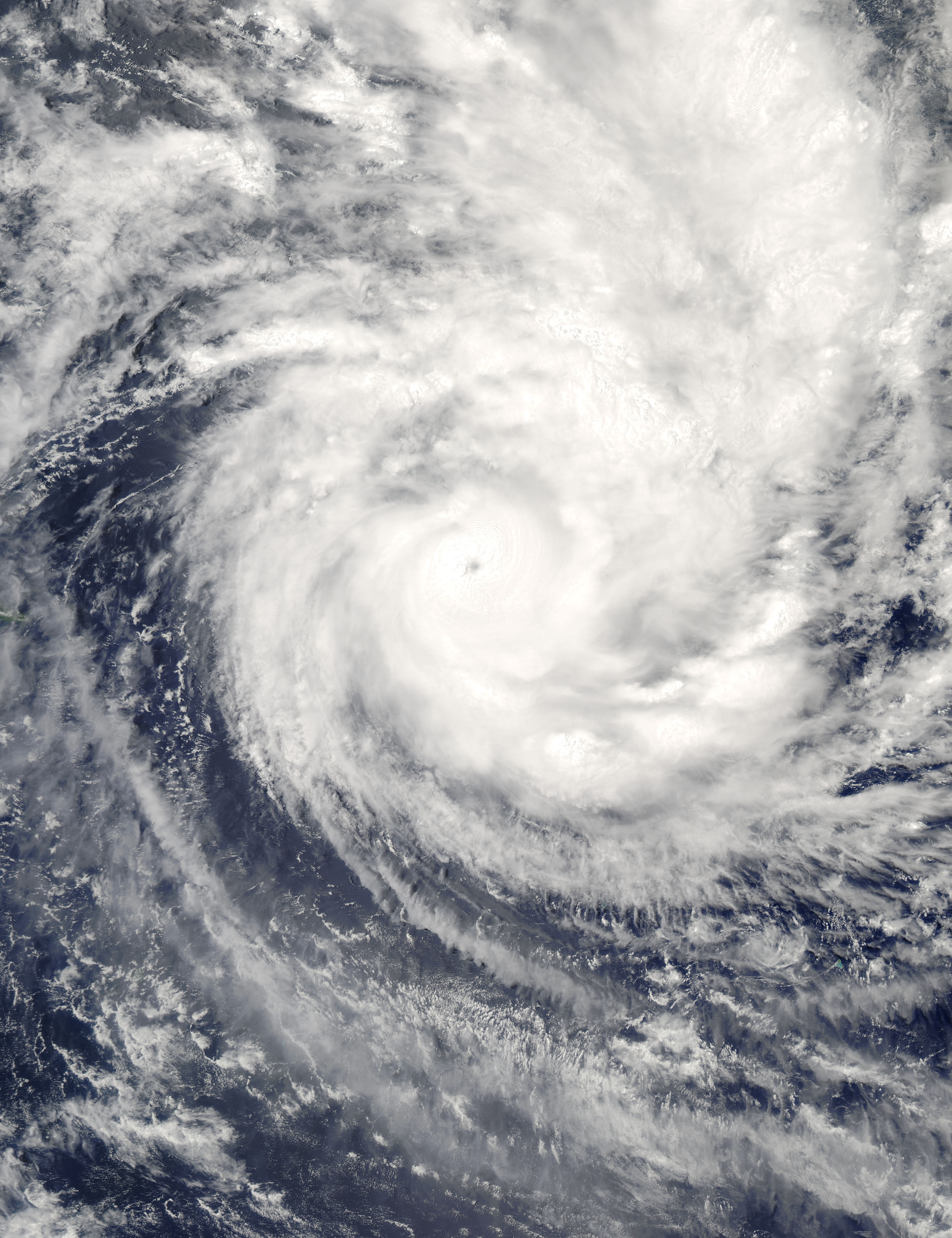
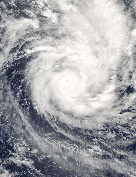
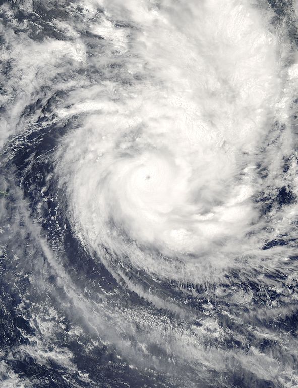
| Descrição | Cyclone Percy continued its rampage across the South Pacific on March 1, 2005, after battering the Northern Cook Islands with its powerful 140-knot wind gusts. This Moderate Resolution Imaging Spectroradiometer (MODIS) image taken by NASA’s Aqua satellite at 2:40 local time on February 28 (00:40 UTC on March 1), shows that the storm now has a clearly defined eye. When the image was taken, Percy had just passed over Pukapuku and Nassau, leaving both in shambles. According to news reports, no structures escaped damage on Nassau and just 10 buildings remain intact in Pukapuku. The storm had sustained winds of 213 kilometers per hour (132 mph) with gusts to 260 kph (160 mph), making it a Category 4 storm on the Saffir-Simpson scale. The storm is weakening as it moves south towards the southern Cook Islands and Rarotonga. Percy is the fourth cyclone to strike the Cook Islands in the past four weeks. | |||||
| Data | ||||||
| Origem | http://visibleearth.nasa.gov/view_rec.php?id=6772 | |||||
| Autor | Jacques Descloitres, MODIS Rapid Response Team, NASA/GSFC | |||||
| Permissão (Reutilizar este ficheiro) |
|

Histórico do ficheiro
Clique uma data e hora para ver o ficheiro tal como ele se encontrava nessa altura.
| Data e hora | Miniatura | Dimensões | Utilizador | Comentário | |
|---|---|---|---|---|---|
| atual | 15h42min de 2 de setembro de 2006 | | 6 000 × 7 800 (5,6 MB) | Good kitty | == Summary == {{Information |Description=Cyclone Percy continued its rampage across the South Pacific on March 1, 2005, after battering the Northern Cook Islands with its powerful 140-knot wind gusts. This Moderate Resolution Imaging Spectroradiometer (MO |
Utilização local do ficheiro
A seguinte página usa este ficheiro:
Utilização global do ficheiro
As seguintes wikis usam este ficheiro:
- en.wikipedia.org
- es.wikipedia.org