
Ficheiro:Moll - The north part of Great Britain called Scotland.png

Imagem numa resolução maior (2 144 × 1 224 píxeis, tamanho: 3,6 MB, tipo MIME: image/png)
|
|
Esta imagem provém do Wikimedia Commons, um acervo de conteúdo livre da Wikimedia Foundation que pode ser utilizado por outros projetos.
|
Descrição do ficheiro
| Descrição |
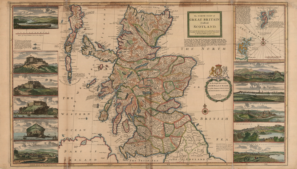
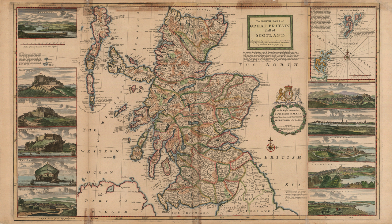
English: A c. 1714 map of Scotland with inset map of the Orkneys and Shetland Islands, many notes on the commercial fishing areas, and illustrations along the side taken from Jacobite broadsheets: Edinburgh, Edinburgh Castle, Stirling, Stirling Castle, Glasgow, Aberdeen, Montrose, Fortrose ("Channery"), St Andrews, Dunnottar Castle, and Bass Rock Castle.
|
|||||||||||||||||||||||
| Data | reprint of a 1714 map | |||||||||||||||||||||||
| Origem | None provided or needed | |||||||||||||||||||||||
| Autor |
|
|||||||||||||||||||||||
| Outras versões |
|
|||||||||||||||||||||||


.jpg)

Licenciamento
|
Esta obra está no domínio público no seu país de origem e noutros países e áreas onde o período de proteção dos direitos de autor é igual ou inferior à vida do autor mais 100 anos. | |
| Este ficheiro foi considerado livre de restrições conhecidas devidas a direitos de autor, incluindo todos os direitos conexos. | |
| Anotações | Esta imagem está anotada: Ver as anotações na wiki Commons |
Histórico do ficheiro
Clique uma data e hora para ver o ficheiro tal como ele se encontrava nessa altura.
| Data e hora | Miniatura | Dimensões | Utilizador | Comentário | |
|---|---|---|---|---|---|
| atual | 10h50min de 16 de setembro de 2005 | | 2 144 × 1 224 (3,6 MB) | Frank Schulenburg | Herman Moll: ''The north part of Great Britain called Scotland: with considerable inprovements and many remarks not extant in any map'', c.1726 (originally published 1714) {{Creator:Herman Moll}} Category:18th century maps |
Utilização local do ficheiro
A seguinte página usa este ficheiro:
Utilização global do ficheiro
As seguintes wikis usam este ficheiro:
- en.wikipedia.org
- es.wikipedia.org
- it.wikipedia.org