
Ficheiro:Smnx frcast map hires.jpg

Dimensões desta antevisão: 470 × 600 píxeis. Outras resoluções: 188 × 240 píxeis | 376 × 480 píxeis | 602 × 768 píxeis | 802 × 1 024 píxeis | 2 160 × 2 757 píxeis.
Imagem numa resolução maior (2 160 × 2 757 píxeis, tamanho: 2,4 MB, tipo MIME: image/jpeg)
|
|
Esta imagem provém do Wikimedia Commons, um acervo de conteúdo livre da Wikimedia Foundation que pode ser utilizado por outros projetos.
|
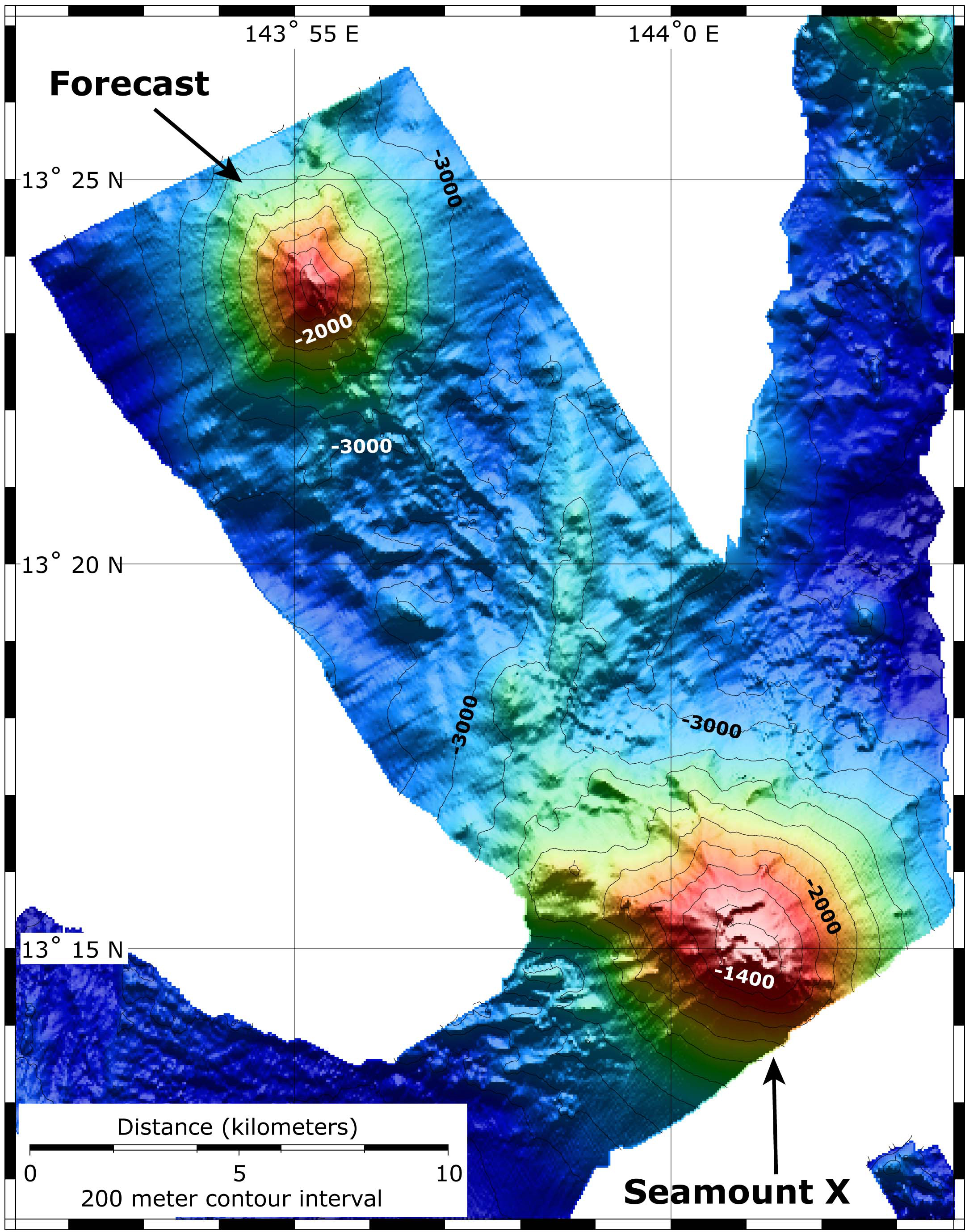
| Descrição | Map showing the location and topography of Seamount X and Forecast. The bathymetry data are a combination of EM300 bathymetry collected on the SRoF'04 expedition, and SeaBeam bathymetry collected on this expedition, just prior to diving on Forecast. |
| Data | |
| Origem | http://oceanexplorer.noaa.gov/explorations/06fire/logs/hires/smnx_frcast_map_hires.jpg |
| Autor | NOAA |
| Permissão (Reutilizar este ficheiro) |
PD |
Esta imagem está em domínio público pois ela contém material que vieram originalmente da National Oceanic and Atmospheric Administration dos EUA, tirada ou feita durante o trajeto de um funcionário em obrigações oficiais.
|
Histórico do ficheiro
Clique uma data e hora para ver o ficheiro tal como ele se encontrava nessa altura.
| Data e hora | Miniatura | Dimensões | Utilizador | Comentário | |
|---|---|---|---|---|---|
| atual | 11h13min de 28 de fevereiro de 2008 | | 2 160 × 2 757 (2,4 MB) | Peko | {{Information |Description=Map showing the location and topography of Seamount X and Forecast. The bathymetry data are a combination of EM300 bathymetry collected on the SRoF'04 expedition, and SeaBeam bathymetry collected on this expedition, just prior t |
Utilização local do ficheiro
A seguinte página usa este ficheiro:
Utilização global do ficheiro
As seguintes wikis usam este ficheiro:
- eu.wikipedia.org
- sk.wikipedia.org
- www.wikidata.org