Ficheiro:Wostok-Station core32.jpg
O conteúdo da página não é suportado noutras línguas.
Origem: Wikipédia, a enciclopédia livre.

Imagem numa resolução maior(1 000 × 644 píxeis, tamanho: 89 kB, tipo MIME: image/jpeg)

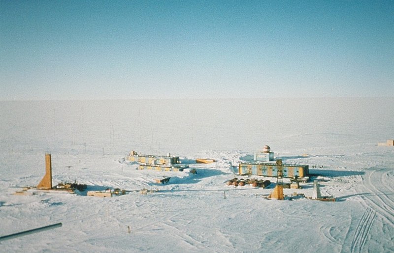
Descrição Wostok-Station (NOAA), photo by Todd Sowers, Lamont-Doherty Earth Observatory (LDEO), Columbia University, Palisades, New York, for NOAA. The Vostok site was chosen by the Soviet Union for the deep coring possibilities it offered. French and, later, American scientists became interested in the Soviet research and began to participate in coring activities at the site. This panoramic photo of Vostok Station shows the layout of the camp. The striped building on the left is the power station while the striped building on the right is where researchers sleep and take meals. The building in the background with the red- and white-striped ball on top is the meteorology building. Caves were dug into the ice sheet for storage, keeping cores at an ideal -55 degrees C year round.
Data (date attribute of the source file)
Origem http://www.ngdc.noaa.gov/paleo/slides/slideset/15/15_300_slide.html
Autor Todd Sowers, Lamont-Doherty Earth Observatory (LDEO), Columbia University, Palisades, New York for NOAA
Permissão
(Reutilizar este ficheiro)
Public domain
Esta imagem está em domínio público pois ela contém material que vieram originalmente da National Oceanic and Atmospheric Administration dos EUA, tirada ou feita durante o trajeto de um funcionário em obrigações oficiais.

العربية  čeština  Deutsch  Zazaki  English  español  eesti  suomi  français  hrvatski  magyar  italiano  日本語  한국어  македонски  മലയാളം  Plattdüütsch  Nederlands  polski  português  română  русский  sicilianu  slovenščina  Türkçe  Tiếng Việt  简体中文  繁體中文  +/−

Localização da câmara 78° 27′ 52″ S, 106° 50′ 50″ E Kartographer map based on OpenStreetMap.Esta e outras imagens nas suas localizações em: OpenStreetMapinfo

Registo de carregamento original

(All user names refer to de.wikipedia)

  • 2004-07-02 17:33 Srbauer 768×494×8 (45575 bytes) Wostok-Station (NOAA)

taken from de.wikipedia; description page is/was here. Original uploader was Srbauer at de.wikipedia

Legendas

Adicione uma explicação de uma linha do que este ficheiro representa
Panoramic view of the Russian Vostok Station, Antarctica, 2001.

Elementos retratados neste ficheiro

retrata

78°27'51.998"S, 106°50'49.999"E

image/jpeg

Histórico do ficheiro

Clique uma data e hora para ver o ficheiro tal como ele se encontrava nessa altura.

Data e horaMiniaturaDimensõesUtilizadorComentário
atual20h21min de 5 de abril de 2007Miniatura da versão das 20h21min de 5 de abril de 20071 000 × 644 (89 kB)Raul6
12h16min de 4 de fevereiro de 2007Miniatura da versão das 12h16min de 4 de fevereiro de 2007768 × 494 (45 kB)Hardscarf{{Information |Description=Wostok-Station (NOAA) Quelle: http://www.ngdc.noaa.gov/paleo/slides/slideset/15/15_300_slide.html Lizenz: PD Beschreibung: Vostok Site The Vostok site was chosen by the Soviet Union for the deep coring possibilities it offer

As seguintes 3 páginas usam este ficheiro:

Utilização global do ficheiro

As seguintes wikis usam este ficheiro:

Ver mais utilizações globais deste ficheiro.

Metadados