
Ficheiro:Paris suburbs Landsat.jpg

Dimensões desta antevisão: 600 × 600 píxeis. Outras resoluções: 240 × 240 píxeis | 480 × 480 píxeis | 768 × 768 píxeis | 1 024 × 1 024 píxeis | 2 401 × 2 401 píxeis.
Imagem numa resolução maior (2 401 × 2 401 píxeis, tamanho: 1,29 MB, tipo MIME: image/jpeg)
|
|
Esta imagem provém do Wikimedia Commons, um acervo de conteúdo livre da Wikimedia Foundation que pode ser utilizado por outros projetos.
|
| Descrição |
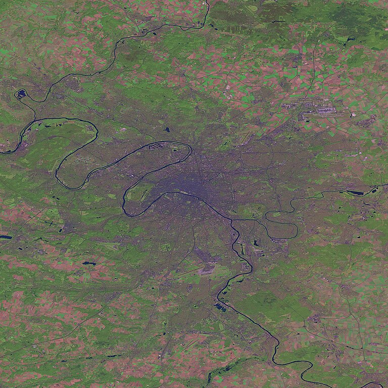
English: Paris and suburbs by Landsat. |
|||
| Origem |
This image was generated by the NGA Raster Roam application, at coordinates 48°51'39"N 2°20'43"E.
|
|||
| Autor | Landsat |

Histórico do ficheiro
Clique uma data e hora para ver o ficheiro tal como ele se encontrava nessa altura.
| Data e hora | Miniatura | Dimensões | Utilizador | Comentário | |
|---|---|---|---|---|---|
| atual | 00h29min de 26 de outubro de 2005 | | 2 401 × 2 401 (1,29 MB) | David.Monniaux | Paris and suburbs by Landsat (false colours) {{NGA Raster Roam|latitude=48°51'39"N|longitude=2°20'43"E}} |
Utilização local do ficheiro
Não há nenhuma página que use este ficheiro.
Utilização global do ficheiro
As seguintes wikis usam este ficheiro:
- fr.wikipedia.org
- vi.wikipedia.org