
Ficheiro:Wfm james ross straight.png

Dimensões desta antevisão: 800 × 593 píxeis. Outras resoluções: 320 × 237 píxeis | 640 × 474 píxeis | 1 024 × 758 píxeis | 1 280 × 948 píxeis.
Imagem numa resolução maior (1 280 × 948 píxeis, tamanho: 2,7 MB, tipo MIME: image/png)
|
|
Esta imagem provém do Wikimedia Commons, um acervo de conteúdo livre da Wikimedia Foundation que pode ser utilizado por outros projetos.
|
Descrição do ficheiro
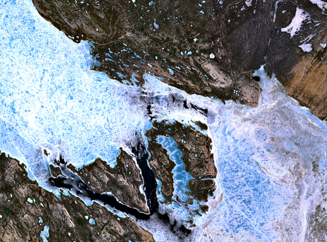
The James Ross Straight northeast of King William Island. Sea ice fills the straight, forming a bridge to Tennent Island (in the west) and Matty Island (further to the east).
NASA Landsat 7 satellite image, collected using NASA World Wind.
Licenciamento
| This image is in the public domain because it is a screenshot from NASA’s globe software World Wind using a public domain layer, such as Blue Marble, MODIS, Landsat, SRTM, USGS or GLOBE.
|
 |
Histórico do ficheiro
Clique uma data e hora para ver o ficheiro tal como ele se encontrava nessa altura.
| Data e hora | Miniatura | Dimensões | Utilizador | Comentário | |
|---|---|---|---|---|---|
| atual | 18h38min de 2 de setembro de 2005 | | 1 280 × 948 (2,7 MB) | Finlay McWalter | The James Ross Straight northeast of en:King William Island. Sea ice fills the straight, forming a bridge to Tennent Island (in the west) and Matty Island (further to the east). NASA Landsat 7 satellite image, collected using NASA World Wind. |
Utilização local do ficheiro
A seguinte página usa este ficheiro:
Utilização global do ficheiro
As seguintes wikis usam este ficheiro:
- bg.wikipedia.org
- de.wikipedia.org
- en.wikipedia.org
- es.wikipedia.org
- fi.wikipedia.org
- fr.wikipedia.org
- it.wikipedia.org
- ja.wikipedia.org
- ml.wikipedia.org
- nl.wikipedia.org
- ru.wikipedia.org
- zh.wikipedia.org