
Ficheiro:IssaouaneErg Algeria ISS010-E-13539.jpg
Imagem numa resolução maior (1 000 × 662 píxeis, tamanho: 491 kB, tipo MIME: image/jpeg)
|
|
Esta imagem provém do Wikimedia Commons, um acervo de conteúdo livre da Wikimedia Foundation que pode ser utilizado por outros projetos.
|
Descrição do ficheiro
| Descrição |
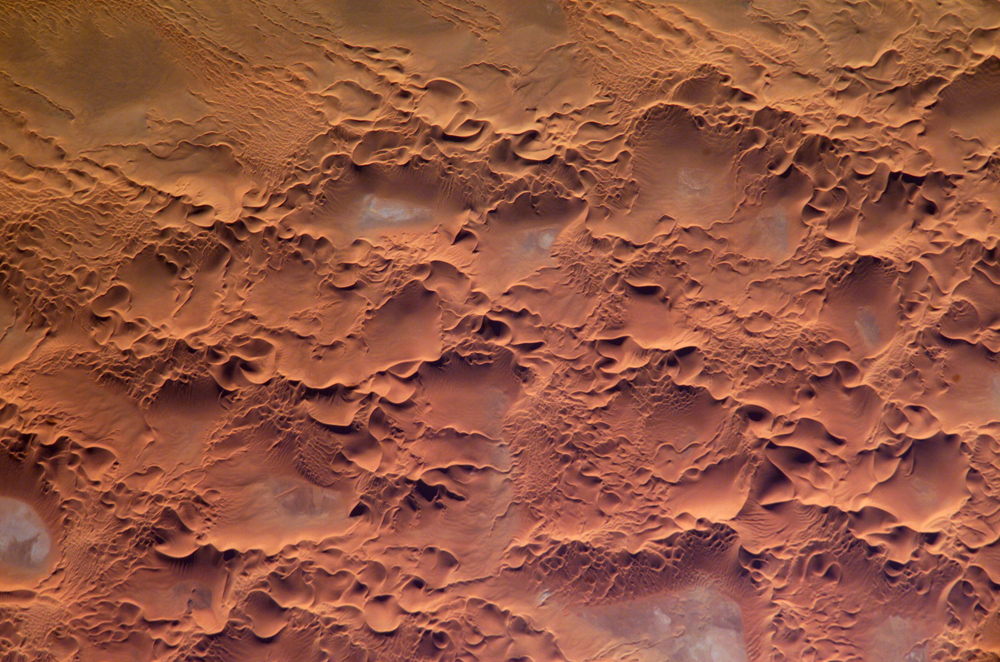
English: Astronaut photo of the Issaouane Erg (Sahara Desert), Algeria.
|
||||||||||||||||||||||||||||||||||||||||||||||||||||||
| Data | |||||||||||||||||||||||||||||||||||||||||||||||||||||||
| Origem | http://earthobservatory.nasa.gov/Newsroom/NewImages/images.php3?img_id=16813 | ||||||||||||||||||||||||||||||||||||||||||||||||||||||
| Autor | ISS Crew Earth Observations experiment and the Image Science & Analysis Group, Johnson Space Center. | ||||||||||||||||||||||||||||||||||||||||||||||||||||||
| Permissão (Reutilizar este ficheiro) |
NASA, public domain | ||||||||||||||||||||||||||||||||||||||||||||||||||||||
Licenciamento
"The Gateway to Astronaut Photography of Earth". Esta imagem é uma cortesia do Laboratório de Ciências e Análises do Centro Espacial Johnson da NASA.
Fonte: ISS010-E-13539.
|
Histórico do ficheiro
Clique uma data e hora para ver o ficheiro tal como ele se encontrava nessa altura.
| Data e hora | Miniatura | Dimensões | Utilizador | Comentário | |
|---|---|---|---|---|---|
| atual | 17h58min de 18 de maio de 2006 | | 1 000 × 662 (491 kB) | Holly Cheng | ==Summary== {{Information | Description=Astronaut photo of the Issaouane Erg (Sahara Desert), Algeria. | Source=http://earthobservatory.nasa.gov/Newsroom/NewImages/images.php3?img_id=16813 | Date=January 16, 2005 | Author=ISS Crew Earth Observations exper |
Utilização local do ficheiro
Não há nenhuma página que use este ficheiro.
Utilização global do ficheiro
As seguintes wikis usam este ficheiro:
- ar.wikipedia.org
- ba.wikipedia.org
- be.wikipedia.org
- bg.wikipedia.org
- br.wikipedia.org
- ceb.wikipedia.org
- da.wikipedia.org
- de.wikipedia.org
- en.wikipedia.org
- eo.wikipedia.org
- fi.wikipedia.org
- fr.wikipedia.org
- fr.wiktionary.org
- hi.wikipedia.org
- it.wikipedia.org
- it.wikibooks.org
- ka.wikipedia.org
- lt.wikipedia.org
- mhr.wikipedia.org
- mk.wikipedia.org
- nn.wikipedia.org
- pl.wikipedia.org
- pl.wiktionary.org
- ro.wikipedia.org
- ru.wikipedia.org
- sl.wikipedia.org
- sr.wikipedia.org
- sv.wikipedia.org
- sv.wiktionary.org
- uk.wikipedia.org
- uz.wikipedia.org
- vi.wikipedia.org
- www.wikidata.org