
Ficheiro:Africa map political-fr.svg

Dimensões desta antevisão em PNG do ficheiro SVG: 635 × 600 píxeis Outras resoluções: 254 × 240 píxeis | 508 × 480 píxeis | 813 × 768 píxeis | 1 084 × 1 024 píxeis | 2 169 × 2 048 píxeis | 1 525 × 1 440 píxeis.
Imagem numa resolução maior (ficheiro SVG, de 1 525 × 1 440 píxeis, tamanho: 754 kB)
|
|
Esta imagem provém do Wikimedia Commons, um acervo de conteúdo livre da Wikimedia Foundation que pode ser utilizado por outros projetos.
|
Descrição do ficheiro
| Descrição |
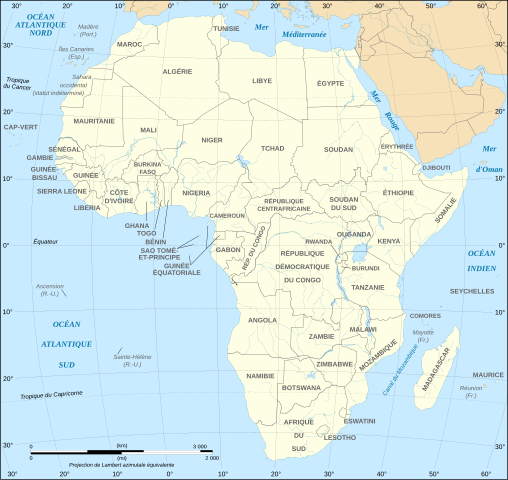
English: Political map in French of Africa as in 2011-07.
Français : Carte politique en français de l'Afrique telle qu'en 07/2011.
Lambert azimutal equal-area projection, WGS84 datum, standard meridian: 15°E, standard parallel: 0° |
||
| Data | June 2008 (new version), updated 2011-07 | ||
| Origem |
Own work
|
||
| Autor | Eric Gaba (Sting - fr:Sting) | ||
| Permissão (Reutilizar este ficheiro) |
|
||
| Outras versões |
Map close to Image:African_continent-fr.svg, but with some changes of the color of the islands administrated by European countries and the Sinai peninsula |

Licenciamento
Eu, titular dos direitos de autor desta obra, publico-a com as seguintes licenças:

|
É concedida permissão para copiar, distribuir e/ou modificar este documento nos termos da Licença de Documentação Livre GNU, versão 1.2 ou qualquer versão posterior publicada pela Free Software Foundation; sem Secções Invariantes, sem textos de Capa e sem textos de Contra-Capa. É incluída uma cópia da licença na secção intitulada GNU Free Documentation License. |
| A utilização deste ficheiro é regulada nos termos da licença Creative Commons - Atribuição-CompartilhaIgual 3.0 Não Adaptada. | ||
| ||
| Esta marca de licenciamento foi adicionada a este ficheiro durante a atualização da licença GFDL. |
A utilização deste ficheiro é regulada nos termos da licença Creative Commons - Atribuição-CompartilhaIgual 2.5 Genérica, 2.0 Genérica e 1.0 Genérica.
- Pode:
- partilhar – copiar, distribuir e transmitir a obra
- recombinar – criar obras derivadas
- De acordo com as seguintes condições:
- atribuição – Tem de fazer a devida atribuição da autoria, fornecer uma hiperligação para a licença e indicar se foram feitas alterações. Pode fazê-lo de qualquer forma razoável, mas não de forma a sugerir que o licenciador o apoia ou subscreve o seu uso da obra.
- partilha nos termos da mesma licença – Se remisturar, transformar ou ampliar o conteúdo, tem de distribuir as suas contribuições com a mesma licença ou uma licença compatível com a original.
Pode escolher a licença que quiser.
Histórico do ficheiro
Clique uma data e hora para ver o ficheiro tal como ele se encontrava nessa altura.
| Data e hora | Miniatura | Dimensões | Utilizador | Comentário | |
|---|---|---|---|---|---|
| atual | 18h39min de 6 de dezembro de 2020 | | 1 525 × 1 440 (754 kB) | Sting | Swaziland => eSwatini |
| 20h23min de 14 de julho de 2011 |  | 1 525 × 1 440 (754 kB) | Sting | Sudan/South Sudan 2011-07 border update | |
| 20h46min de 10 de janeiro de 2009 |  | 1 525 × 1 440 (749 kB) | Sting | Correction Sao Tome | |
| 23h09min de 27 de junho de 2008 |  | 1 525 × 1 440 (749 kB) | Sting | Completely new drawing with known projection ; new colors | |
| 13h20min de 24 de abril de 2007 |  | 1 390 × 1 295 (609 kB) | Moyogo | noms courts : Centrafrique, Congo-Brazzaville, Congo-Kinshasa | |
| 16h46min de 21 de setembro de 2006 |  | 1 390 × 1 295 (609 kB) | Sting | Colours | |
| 21h21min de 31 de maio de 2006 |  | 1 390 × 1 295 (608 kB) | Sting | {{Information |Description=Political map of Africa with French caption |Source=Several bitmap-type maps |Date= May 2006 |Author= Eric Gaba (Sting) |Permission=GFDL or CC-BY-SA |other_versions=[[:Image:Africa_map |
Utilização local do ficheiro
Não há nenhuma página que use este ficheiro.
Utilização global do ficheiro
As seguintes wikis usam este ficheiro:
- de.wikipedia.org
- fr.wikipedia.org
- fr.wikinews.org
- gl.wikipedia.org
- ln.wikipedia.org
- sk.wikipedia.org