
Ficheiro:Hurricane Paula 2010-10-12 1620Z.jpg
Imagem numa resolução maior (5 600 × 5 600 píxeis, tamanho: 8,06 MB, tipo MIME: image/jpeg)
|
|
Esta imagem provém do Wikimedia Commons, um acervo de conteúdo livre da Wikimedia Foundation que pode ser utilizado por outros projetos.
|
Descrição do ficheiro
| Descrição |
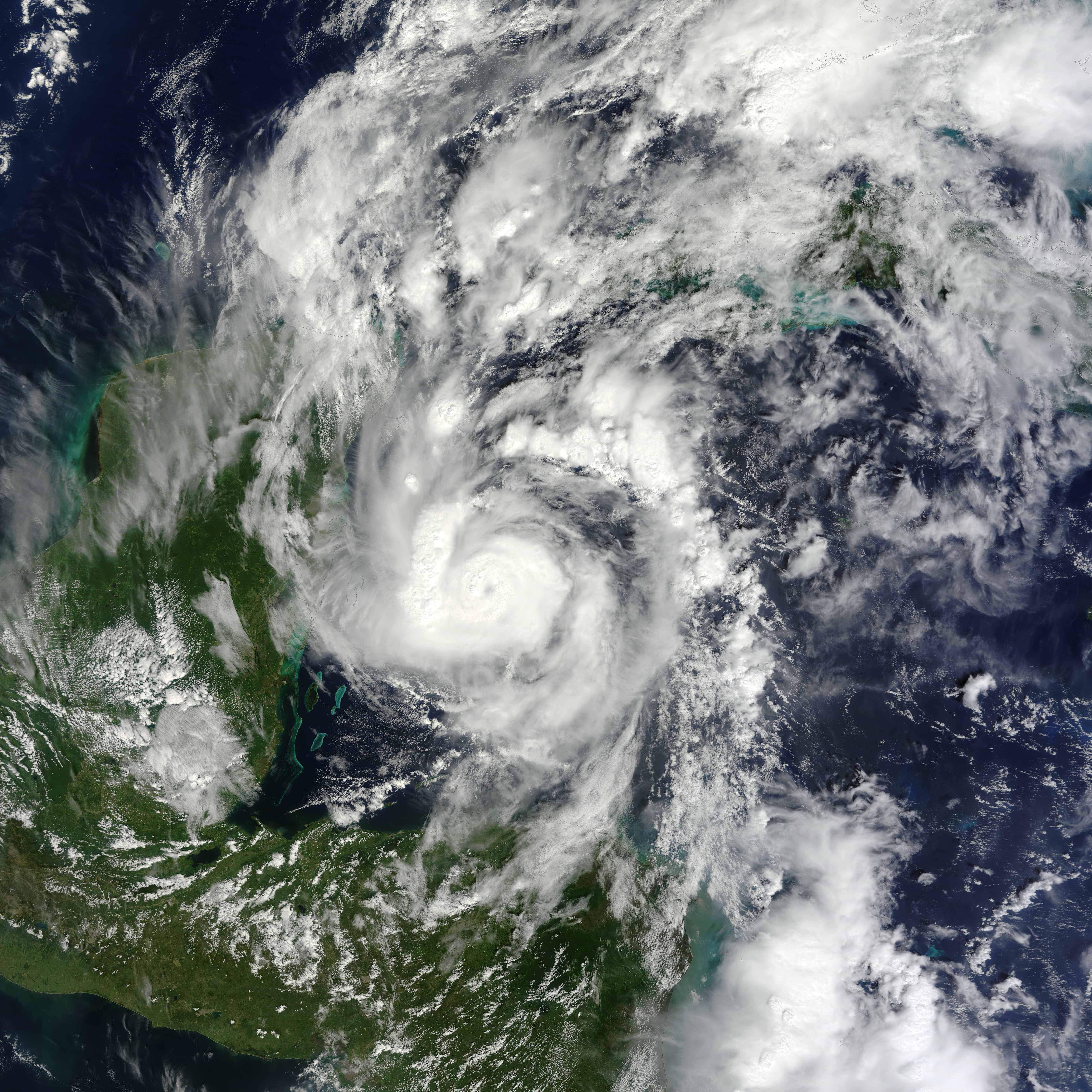
English: Small but powerful, Hurricane Paula packed winds of 100 miles (160 kilometers) per hour on October 12, 2010. At 12:45 p.m. Central Daylight Time (CDT), the U.S. National Hurricane Center (NHC) reported that Paula was a Category 2 hurricane, located roughly 140 miles (220 kilometers) south-southeast of Cozumel, Mexico, and was traveling slowly toward the north-northwest.
The Moderate Resolution Imaging Spectroradiometer (MODIS) on NASA’s Terra satellite captured this natural-color image of Hurricane Paula at 11:20 a.m. CDT (16:20 UTC) on October 12 while over the Caribbean Sea, just off the coasts of Mexico, Belize, and Honduras. Coiled around a distinct eye, the storm’s most intense clouds spanned roughly 200 kilometers (125 miles). By October 14, 2010, Paula had weakened to a tropical storm. At 10:00 a.m. CDT on October 14, the NHC reported that Paula had winds of 70 miles (110 kilometers) per hour. Though less intense than it had been two days earlier, Paula still posed hazards. A tropical storm warning was in effect for parts of Cuba, and a tropical storm watch was in effect for parts of the Florida Keys. The NHC warned of high winds and heavy rains—amounting to 10 inches (25 centimeters) in isolated areas. |
| Data | |
| Origem | [1] |
| Autor | NASA image by Jeff Schmaltz, MODIS Rapid Response Team at NASA GSFC. Caption by Michon Scott. |
Licenciamento
| Este ficheiro está no domínio público nos Estados Unidos porque foi criado exclusivamente pela NASA. As orientações sobre o direito de autor da NASA são que «as obras da NASA não têm os direitos de autor protegidos salvo indicação em contrário». Veja Template:PD-USGov, as orientações sobre o direito de autor da NASA ou as normas de uso de imagens do Laboratório de Propulsão a Jato (Jet Propulsion Lab, JPL). | ||
 |
Avisos:
|
Histórico do ficheiro
Clique uma data e hora para ver o ficheiro tal como ele se encontrava nessa altura.
| Data e hora | Miniatura | Dimensões | Utilizador | Comentário | |
|---|---|---|---|---|---|
| atual | 03h33min de 28 de junho de 2013 | | 5 600 × 5 600 (8,06 MB) | HurricaneSpin | cropped |
| 22h56min de 12 de outubro de 2010 |  | 5 600 × 7 200 (6,19 MB) | HurricaneSpin | {{Information |Description={{en|1=Hurricane Paula.}} |Source=[http://rapidfire.sci.gsfc.nasa.gov/gallery/?2010285-1012/Paula.A2010285.1620.2km.jpg] |Author=NASA/MODIS Rapid Response System |Date=2010-10-12 |Permission=See below |other_versions= }} [[Cate |
Utilização local do ficheiro
A seguinte página usa este ficheiro:
Utilização global do ficheiro
As seguintes wikis usam este ficheiro:
- de.wikipedia.org
- en.wikipedia.org
- en.wikinews.org
- es.wikipedia.org
- fr.wikipedia.org
- ko.wikipedia.org
- nl.wikipedia.org
- simple.wikipedia.org
- www.wikidata.org
- zh.wikipedia.org