
Ficheiro:Kuwait-Iraq barrier.png

Imagem numa resolução maior (1 060 × 1 218 píxeis, tamanho: 964 kB, tipo MIME: image/png)
|
|
Esta imagem provém do Wikimedia Commons, um acervo de conteúdo livre da Wikimedia Foundation que pode ser utilizado por outros projetos.
|
Transwiki approved by: w:en:User:Dmcdevit
This image was copied from wikipedia:en. The original description was:
Original map license (map from the CIA):
| Esta imagem é trabalho de um funcionário da Central Intelligence Agency, tirada ou feita durante o curso dos deveres oficias da pessoa. Como um trabalho do Governo dos Estados Unidos, todas as imagens criadas ou feitas pela CIA estão em domínio público.
|

|
Source: Courtesy of the University of Texas Libraries, The University of Texas at Austin for the map originally found at : http://www.lib.utexas.edu/maps/middle_east_and_asia/kuwait_pol96.jpg
Modified map license (the one that can be seen here)
| Eu, titular dos direitos de autor desta obra, dedico-a ao domínio público, com aplicação em todo o mundo. Nalguns países isto pode não ser legalmente possível; se assim for: Concedo a todos o direito de usar esta obra para qualquer fim, sem quaisquer condições, a menos que tais condições sejam impostas por lei. |
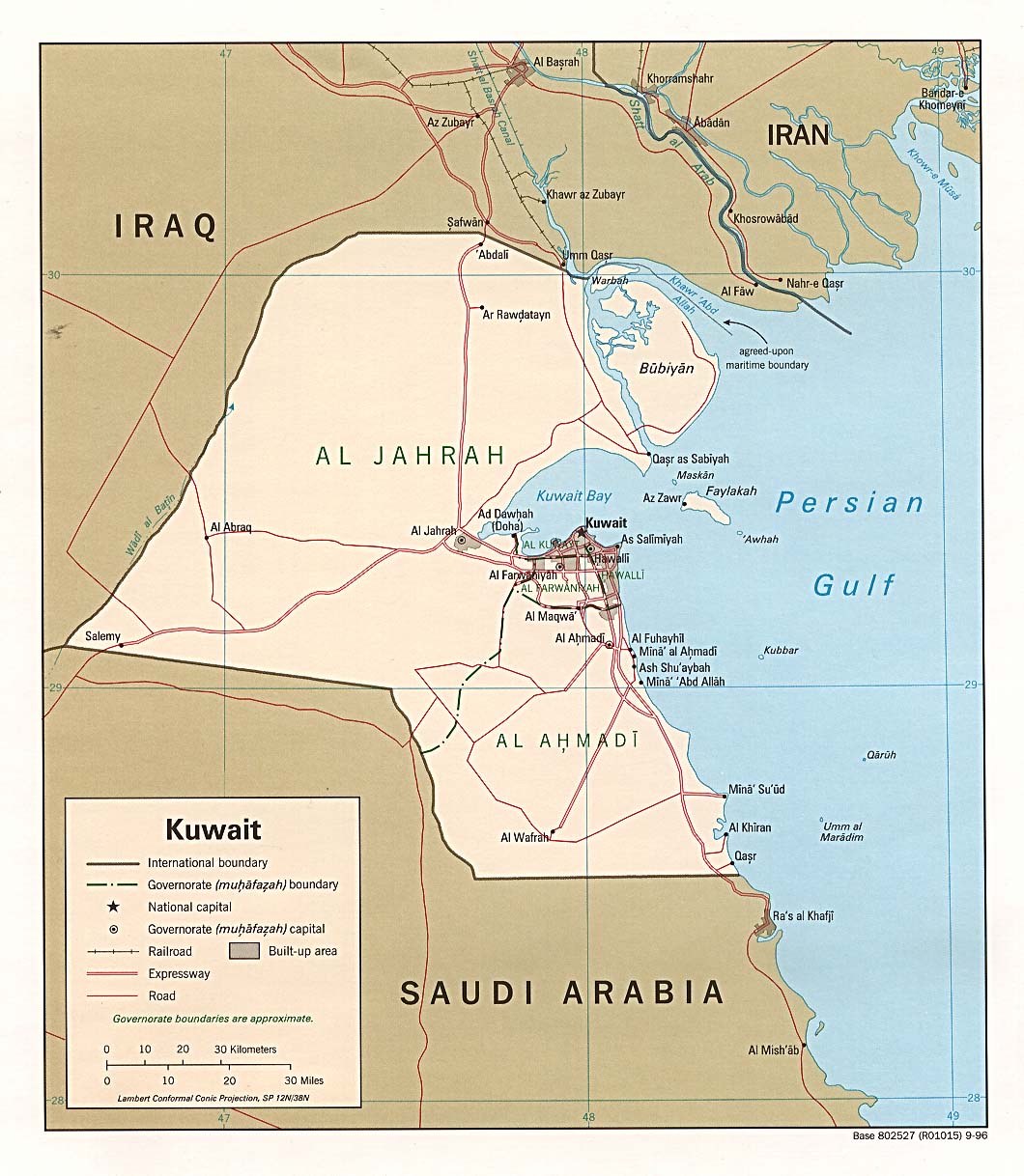
I drew the barrier on the map, based on the fact it extends 6 miles into Iraq and 3 into Kuwait.
Note
Even though this is a .png file the original file is .jpg, so the quality is fairly low.
.xcf version, can be opened in w:en:GIMP
Registo de carregamento original
| date/time | username | resolution | size | edit summary |
|---|---|---|---|---|
| 16:27, 21 June 2007 | w:en:User:Jackaranga | 1060×1218 | 1.38 MB | {{BadJPG}} ==Original map license (map from the CIA):== {{PD-USgov}} Source: ''Courtesy of the University of Texas Libraries, The University of Texas at Austin'' for the map originally found at : http://www.lib.utexas.edu/maps/middle_east_and_asia/kuwait |
Image description page history
| link | date/time | username | edit summary |
|---|---|---|---|
| http://en.wikipedia.org/w/index.php?title=Image:Kuwait-Iraq_barrier.png&redirect=no&oldid=139701165 | 08:50, 7 September 2007 | w:en:User:Dmcdevit | |
| http://en.wikipedia.org/w/index.php?title=Image:Kuwait-Iraq_barrier.png&redirect=no&oldid=139701165 | 16:52, 21 June 2007 | w:en:User:Jackaranga | |
| http://en.wikipedia.org/w/index.php?title=Image:Kuwait-Iraq_barrier.png&redirect=no&oldid=139696697 | 16:31, 21 June 2007 | w:en:User:Jackaranga | |
| http://en.wikipedia.org/w/index.php?title=Image:Kuwait-Iraq_barrier.png&redirect=no&oldid=139695842 | 16:27, 21 June 2007 | w:en:User:Jackaranga | ({{BadJPG}} ==Original map license (map from the CIA):== {{PD-USgov}} Source: ''Courtesy of the University of Texas Libraries, The University of Texas at Austin'' for the map originally found at : http://www.lib.utexas.edu/maps/middle_east_and_asia/kuwait) |
Histórico do ficheiro
Clique uma data e hora para ver o ficheiro tal como ele se encontrava nessa altura.
| Data e hora | Miniatura | Dimensões | Utilizador | Comentário | |
|---|---|---|---|---|---|
| atual | 22h42min de 7 de abril de 2021 | | 1 060 × 1 218 (964 kB) | JohnVanVliet | jpg artifact removal |
| 04h51min de 8 de setembro de 2007 |  | 1 060 × 1 218 (1,38 MB) | BetacommandBot | Transwiki approved by: w:en:User:Dmcdevit This image was copied from wikipedia:en. The original description was: {{BadJPG}} ==Original map license (map from the CIA):== {{PD-USGov-CIA}} Source: ''Courtesy of the University of Texas Libraries, The U |
Utilização local do ficheiro
A seguinte página usa este ficheiro:
Utilização global do ficheiro
As seguintes wikis usam este ficheiro:
- ar.wikipedia.org
- ca.wikipedia.org
- ckb.wikipedia.org
- de.wikipedia.org
- en.wikipedia.org
- es.wikipedia.org
- fa.wikipedia.org
- fr.wikipedia.org
- id.wikipedia.org
- ja.wikipedia.org
- mzn.wikipedia.org
- nl.wikipedia.org
- pl.wikipedia.org
- tg.wikipedia.org
- uk.wikipedia.org
- www.wikidata.org
- zh.wikipedia.org