
Ficheiro:Taman map.png
Sem resolução maior disponível.
Taman_map.png (452 × 330 píxeis, tamanho: 33 kB, tipo MIME: image/png)
|
|
Esta imagem provém do Wikimedia Commons, um acervo de conteúdo livre da Wikimedia Foundation que pode ser utilizado por outros projetos.
|
Descrição do ficheiro
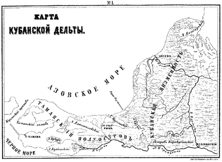
| Descrição | A map of the Taman peninsula. |
| Origem | From Gerz, K. Arkheologicheskaya topografiya Tamanskogo poluostrova. Moscow: The Moscow Archaeological Society, 1870. |
| Autor |
Licenciamento
This file is a Ukrainian or Ukrainian SSR work and it is presently in the public domain in Ukraine, because it was published before January 1, 1954, and the creator (if known) died before that date (details).
|
 |
Esta obra está no domínio público nos Estados Unidos porque foi publicada (ou registada no U.S. Copyright Office) antes de 1 de janeiro de 1929.
Para que possam ser alojadas na wiki Commons, as obras que estão no domínio público não podem ter os direitos de autor protegidos, nem nos Estados Unidos nem no país de origem da obra. Se esta obra não tem origem nos EUA, o ficheiro tem de ter uma marcação de direitos de autor adicional que indique o estado dos direitos de autor no país de origem.
|
Histórico do ficheiro
Clique uma data e hora para ver o ficheiro tal como ele se encontrava nessa altura.
| Data e hora | Miniatura | Dimensões | Utilizador | Comentário | |
|---|---|---|---|---|---|
| atual | 06h44min de 19 de abril de 2007 | | 452 × 330 (33 kB) | Joonasl | {{Information |Description=A map of the Taman peninsula. |Source=From Gerz, K. ''Arkheologicheskaya topografiya Tamanskogo poluostrova.'' Moscow: The Moscow Archaeological Society, 1870. |Date= |Author= |Permission= |other_versions= }} {{PD-Russia}} [[C |
Utilização local do ficheiro
A seguinte página usa este ficheiro:
Utilização global do ficheiro
As seguintes wikis usam este ficheiro:
- az.wikipedia.org
- bg.wikipedia.org
- el.wikipedia.org
- en.wikipedia.org
- eo.wikipedia.org
- es.wikipedia.org
- fi.wikipedia.org
- fr.wikipedia.org
- hi.wikipedia.org
- hr.wikipedia.org
- hy.wikipedia.org
- id.wikipedia.org
- it.wikipedia.org
- ja.wikipedia.org
- ka.wikipedia.org
- la.wikipedia.org
- ml.wikipedia.org
- mt.wikipedia.org
- nn.wikipedia.org
- ru.wikipedia.org
- sh.wikipedia.org
- sl.wikipedia.org
- sr.wikipedia.org
- sv.wikipedia.org
- tr.wikipedia.org
- uk.wikipedia.org